
קובץ:Arunachal Pradesh locator map.svg

גודל התצוגה המקדימה הזאת מסוג PNG של קובץ ה־SVG הזה: 734 × 600 פיקסלים. רזולוציות אחרות: 294 × 240 פיקסלים | 587 × 480 פיקסלים | 940 × 768 פיקסלים | 1,253 × 1,024 פיקסלים | 2,506 × 2,048 פיקסלים | 2,393 × 1,956 פיקסלים.
לקובץ המקורי (קובץ SVG, הגודל המקורי: 2,393 × 1,956 פיקסלים, גודל הקובץ: 263 ק"ב)
| זהו קובץ שמקורו במיזם ויקישיתוף. תיאורו בדף תיאור הקובץ המקורי (בעברית) מוצג למטה. |
| כותר |
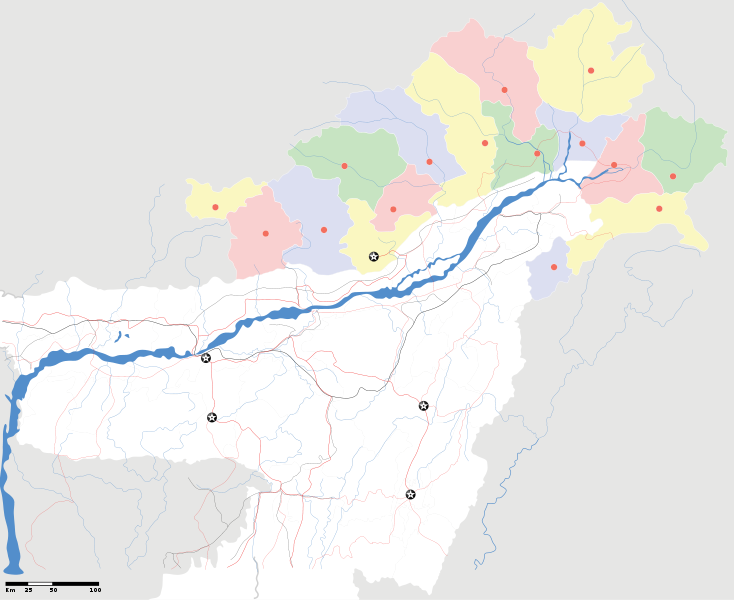
Arunachal Pradesh locator Map. Coordinates: top=29.49, bottom=23.74, left=89.61, right=97.52. |
||
| תיאור |
Map of w:Arunachal Pradesh with road and rail lines |
||
| תאריך יצירה | |||
| מקור |
נוצר על־ידי מעלה היצירה |
||
| יוצר |
|
||
| אישורים והיתרים (שימוש חוזר בקובץ זה) |
אני, בעל זכויות היוצרים על עבודה זו, מפרסם בזאת את העבודה תחת הרישיון הבא: הקובץ הזה מתפרסם לפי תנאי רישיון קריאייטיב קומונז ייחוס-שיתוף זהה 3.0 לא מותאם.
|
||
| Geotemporal data | |||
| תאריך מתואר | במחצית השנייה של המאה ה-20 ו- המאה ה-21 | ||
| Georeferencing | If inappropriate please set warp_status = skip to hide. | ||
| Archival data | |||
| הערות | Part of WikiProject India Maps | ||
derivative works
Derivative works of this file: India Arunachal Pradesh location map.svg
היסטוריית הקובץ
ניתן ללחוץ על תאריך/שעה כדי לראות את הקובץ כפי שנראה באותו זמן.
| תאריך/שעה | תמונה ממוזערת | ממדים | משתמש | הערה | |
|---|---|---|---|---|---|
| נוכחית | 22:04, 16 באפריל 2007 | | 1,956 × 2,393 (263 ק"ב) | Planemad | {{WikiProject_India_Maps |Title=Arunachal Pradesh locator Map |Description=Map of w:Arunachal Pradesh with road and rail lines |Source= [http://www.iitg.ernet.in/rcilts/assam_political.jpg IIT Guwahati - Assam Political map], [http://arunachalgovernor |
שימוש בקובץ
![]() אין בוויקיפדיה דפים המשתמשים בקובץ זה.
אין בוויקיפדיה דפים המשתמשים בקובץ זה.
שימוש גלובלי בקובץ
אתרי הוויקי השונים הבאים משתמשים בקובץ זה:
- שימוש באתר ast.wikipedia.org
- שימוש באתר as.wikipedia.org
- שימוש באתר awa.wikipedia.org
- שימוש באתר ba.wikipedia.org
- שימוש באתר ca.wikipedia.org
- שימוש באתר ceb.wikipedia.org
- שימוש באתר de.wikipedia.org
- שימוש באתר dty.wikipedia.org
- שימוש באתר dv.wikipedia.org
- שימוש באתר en.wikipedia.org
- שימוש באתר es.wikipedia.org
- שימוש באתר fa.wikipedia.org
- שימוש באתר fr.wikipedia.org
- שימוש באתר hif.wikipedia.org
- שימוש באתר hi.wikipedia.org
- שימוש באתר hr.wikipedia.org
- שימוש באתר id.wikipedia.org
- שימוש באתר incubator.wikimedia.org
- שימוש באתר ja.wikipedia.org
- שימוש באתר ka.wikipedia.org
- שימוש באתר kbd.wikipedia.org
- שימוש באתר mai.wikipedia.org
- שימוש באתר ml.wikipedia.org
- שימוש באתר ms.wikipedia.org
- שימוש באתר new.wikipedia.org
- שימוש באתר nl.wikipedia.org