
קובץ:Crookston Minnesota aerial view.jpg
גודל התצוגה המקדימה הזאת: 800 × 562 פיקסלים. רזולוציות אחרות: 320 × 225 פיקסלים | 640 × 449 פיקסלים | 1,024 × 719 פיקסלים | 1,280 × 899 פיקסלים | 1,500 × 1,053 פיקסלים.
לקובץ המקורי (1,500 × 1,053 פיקסלים, גודל הקובץ: 820 ק"ב, סוג MIME: image/jpeg)
| זהו קובץ שמקורו במיזם ויקישיתוף. תיאורו בדף תיאור הקובץ המקורי (בעברית) מוצג למטה. |
| תיאור |
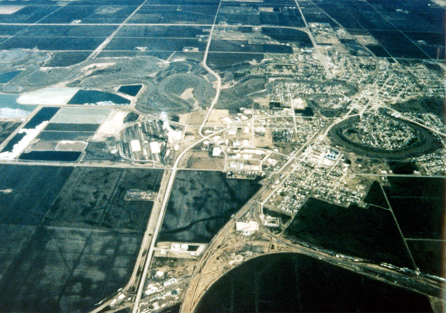
English: Aerial view of Crookston, Minnesota, USA. The Red Lake River twists and turns on its way through the city. The Red Lake River runs west-northwest to join the Red River about 22 miles (straight line) west of Crookston at Grand Forks, North Dakota (hence the name Grand Forks). |
|||
| תאריך יצירה | ||||
| מקור |
U.S. Army Corps of Engineers Digital Visual Library Image page Image description page Digital Visual Library home page |
|||
| יוצר | Tom Crump, U.S. Army Corps of Engineers | |||
| אישורים והיתרים (שימוש חוזר בקובץ זה) |
|
|||
| מיקום | Crookston, Minnesota, USA |
| מיקום המצלמה | | תמונה זו ותמונות נוספות במיקום: OpenStreetMap |
|---|
היסטוריית הקובץ
ניתן ללחוץ על תאריך/שעה כדי לראות את הקובץ כפי שנראה באותו זמן.
| תאריך/שעה | תמונה ממוזערת | ממדים | משתמש | הערה | |
|---|---|---|---|---|---|
| נוכחית | 06:47, 7 באפריל 2007 | | 1,053 × 1,500 (820 ק"ב) | DanMS | {{Information | Description = {{en|Aerial view of Crookston, Minnesota, USA. The Red Lake River twists and turns on its way through the city. The Red Lake River runs west-northwest to join the Red River about 22 miles (straight line) west of Crookston |
שימוש בקובץ
הדף הבא משתמש בקובץ הזה:
שימוש גלובלי בקובץ
אתרי הוויקי השונים הבאים משתמשים בקובץ זה:
- שימוש באתר de.wikipedia.org
- שימוש באתר en.wikipedia.org
- שימוש באתר it.wikipedia.org
- שימוש באתר nn.wikipedia.org
- שימוש באתר pl.wikipedia.org