
קובץ:Jharkhand locator map.svg

גודל התצוגה המקדימה הזאת מסוג PNG של קובץ ה־SVG הזה: 505 × 599 פיקסלים. רזולוציות אחרות: 202 × 240 פיקסלים | 404 × 480 פיקסלים | 647 × 768 פיקסלים | 863 × 1,024 פיקסלים | 1,726 × 2,048 פיקסלים | 1,614 × 1,915 פיקסלים.
לקובץ המקורי (קובץ SVG, הגודל המקורי: 1,614 × 1,915 פיקסלים, גודל הקובץ: 231 ק"ב)
| זהו קובץ שמקורו במיזם ויקישיתוף. תיאורו בדף תיאור הקובץ המקורי (בעברית) מוצג למטה. |
| כותר |
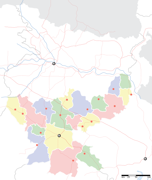
Jharkhand locator map |
||
| תיאור |
Locator map for the Indian state of w:Jharkhand. Equirectangular projection. Geographic limits of the map: top=27.561, bottom=21.92, left=83.25, right=88.52. |
||
| תאריך יצירה | |||
| מקור |
נוצר על־ידי מעלה היצירה |
||
| יוצר |
|
||
| אישורים והיתרים (שימוש חוזר בקובץ זה) |
אני, בעל זכויות היוצרים על עבודה זו, מפרסם בזאת את העבודה תחת הרישיון הבא: הקובץ הזה מתפרסם לפי תנאי רישיון קריאייטיב קומונז ייחוס-שיתוף זהה 3.0 לא מותאם.
|
||
| Geotemporal data | |||
| תאריך מתואר | במחצית השנייה של המאה ה-20 ו- המאה ה-21 | ||
| Georeferencing | If inappropriate please set warp_status = skip to hide. | ||
| Archival data | |||
| הערות | Part of WikiProject India Maps | ||
היסטוריית הקובץ
ניתן ללחוץ על תאריך/שעה כדי לראות את הקובץ כפי שנראה באותו זמן.
| תאריך/שעה | תמונה ממוזערת | ממדים | משתמש | הערה | |
|---|---|---|---|---|---|
| נוכחית | 09:46, 7 בספטמבר 2008 | | 1,915 × 1,614 (231 ק"ב) | Planemad | |
| 23:18, 6 בספטמבר 2008 |  | 1,915 × 1,614 (183 ק"ב) | Planemad | {{Information |Description={{en|1=a}} |Source=Own work by uploader |Author=PlaneMad |Date= |Permission= |other_versions= }} <!--{{ImageUpload|full}}--> |
שימוש בקובץ
![]() אין בוויקיפדיה דפים המשתמשים בקובץ זה.
אין בוויקיפדיה דפים המשתמשים בקובץ זה.
שימוש גלובלי בקובץ
אתרי הוויקי השונים הבאים משתמשים בקובץ זה:
- שימוש באתר ar.wikipedia.org
- שימוש באתר ast.wikipedia.org
- שימוש באתר as.wikipedia.org
- שימוש באתר awa.wikipedia.org
- שימוש באתר ba.wikipedia.org
- שימוש באתר bh.wikipedia.org
- שימוש באתר bn.wikipedia.org
- রাঁচি
- সম্মেদ শিখর
- টেমপ্লেট:অবস্থান মানচিত্র ভারত ঝাড়খণ্ড
- ঘাটশিলা
- রাজমহল
- নেতারহাট
- মুরি
- বোকারো স্টিল সিটি
- জামতাড়া
- সোনারী বিমানবন্দর
- চাইবাসা
- চক্রধরপুর
- সাহেবগঞ্জ
- রাজমহল কয়লা খনি অঞ্চল
- বোকারো বিমানবন্দর
- পাঞ্চেত বাঁধ
- ব্যবহারকারী:খাঁ শুভেন্দু/রাঁচি
- সরাইকেল্লা
- দেওঘর বিমানবন্দর
- গিরিডি
- দুগদা
- মেদিনীনগর
- দুমকা
- রাঁচি জংশন রেলওয়ে স্টেশন
- হাজারিবাগ টাউন রেলওয়ে স্টেশন
- ধলভূমগড়
- ধলভূমগড় ব্লক
- জগন্নাথ মন্দির, রাঁচি
- שימוש באתר bo.wikipedia.org
- שימוש באתר ceb.wikipedia.org
- שימוש באתר de.wikipedia.org
- שימוש באתר fa.wikipedia.org
- שימוש באתר hi.wikipedia.org