
קובץ:Kiribati-Vostok-highlighted.png
אין גרסה ברזולוציה גבוהה יותר.
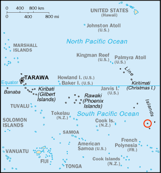
Kiribati-Vostok-highlighted.png (330 × 354 פיקסלים, גודל הקובץ: 18 ק"ב, סוג MIME: image/png)
| זהו קובץ שמקורו במיזם ויקישיתוף. תיאורו בדף תיאור הקובץ המקורי (בעברית) מוצג למטה. |

|
יש ליצור מחדש את התמונה map הזו באמצעות גרפיקה וקטורית כדוגמת קובץ SVG. לפעולה זו מספר יתרונות, כפי שניתן לקרוא (באנגלית) בדף Commons:Media for cleanup. אם ברשותכם קובץ SVG, אנא העלו אותו. לאחר מכן, החליפו תבנית זו בתבנית
{{vector version available|שם הקובץ.svg}} |
תקציר
| תיאור |
English: Map of Kiribati, adapted version of the post-1995 South Pacific section of Kr-map.png with Vostok Island highlighted |
| תאריך יצירה | |
| מקור | https://www.cia.gov/cia/publications/factbook/geos/kr.html |
| יוצר | נוצר על־ידי מעלה היצירה, based on original |
| גרסאות אחרות | original version |
רישיון
This image is in the public domain because it contains materials that originally came from the United States Central Intelligence Agency's World Factbook.
|
 |
| This work was previously under Public Domain, or a Free License. It has been digitally enhanced and/or modified. This derivative work has been (or is hereby) released into the public domain by its author, Telim tor at the German Wikipedia project. This applies worldwide. In some countries this is not legally possible; if so:
|
היסטוריית הקובץ
ניתן ללחוץ על תאריך/שעה כדי לראות את הקובץ כפי שנראה באותו זמן.
| תאריך/שעה | תמונה ממוזערת | ממדים | משתמש | הערה | |
|---|---|---|---|---|---|
| נוכחית | 13:07, 27 באפריל 2007 | | 354 × 330 (18 ק"ב) | Telim tor | == Information == {{Information |Description= Map of Kiribati, adapted version of the post-1995 South Pacific section of Kr-map.png with with '''Vostok Island''' highlighted |Source=https://www.cia.gov/cia/publications/factbook/geos/kr.html |Date=27th Apr |
שימוש בקובץ
הדף הבא משתמש בקובץ הזה:
שימוש גלובלי בקובץ
אתרי הוויקי השונים הבאים משתמשים בקובץ זה:
- שימוש באתר en.wikipedia.org
- שימוש באתר es.wikipedia.org
- שימוש באתר fa.wikipedia.org
- שימוש באתר it.wikipedia.org
- שימוש באתר ko.wikipedia.org
- שימוש באתר lt.wikipedia.org
- שימוש באתר pl.wikipedia.org
- שימוש באתר ru.wikipedia.org