
קובץ:Map of Solomons area in 1942.png
גודל התצוגה המקדימה הזאת: 800 × 432 פיקסלים. רזולוציות אחרות: 320 × 173 פיקסלים | 640 × 346 פיקסלים | 1,200 × 648 פיקסלים.
לקובץ המקורי (1,200 × 648 פיקסלים, גודל הקובץ: 341 ק"ב, סוג MIME: image/png)
| זהו קובץ שמקורו במיזם ויקישיתוף. תיאורו בדף תיאור הקובץ המקורי (בעברית) מוצג למטה. |
תקציר
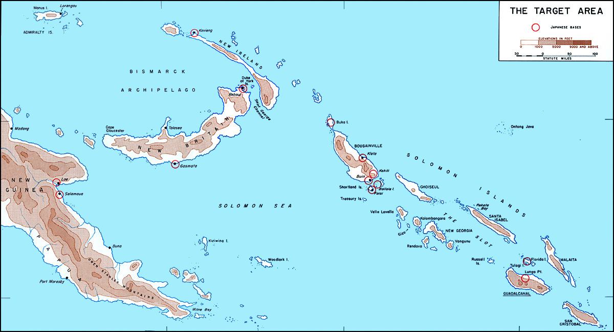
| תיאור |
English: Map of Solomons area in 1942 before invasion of Guadalcanal showing Japanese bases circled in red. Image fixed by Angelus (talk).
Italiano: Cartina delle Isole Salomone nel 1942, prima dell'invasione di Guadalcanal. Le basi giapponesi sono cerchiate in rosso. Immagine corretta da Angelus (talk). |
||||||
| מקור | www.ibiblio.org | ||||||
| יוצר | derivative version: Angelus | ||||||
| אישורים והיתרים (שימוש חוזר בקובץ זה) |
|
||||||

היסטוריית הקובץ
ניתן ללחוץ על תאריך/שעה כדי לראות את הקובץ כפי שנראה באותו זמן.
| תאריך/שעה | תמונה ממוזערת | ממדים | משתמש | הערה | |
|---|---|---|---|---|---|
| נוכחית | 19:44, 26 במאי 2011 | | 648 × 1,200 (341 ק"ב) | ANGELUS | == {{int:filedesc}} == {{Information |Description= {{en|Map of Solomons area in 1942 before invasion of Guadalcanal showing Japanese bases circled in red. Modified by ~~~.}} {{it|Cartina delle [[w:it:Isole Sal |
שימוש בקובץ
הדף הבא משתמש בקובץ הזה:
שימוש גלובלי בקובץ
אתרי הוויקי השונים הבאים משתמשים בקובץ זה:
- שימוש באתר ast.wikipedia.org
- שימוש באתר da.wikipedia.org
- שימוש באתר en.wikipedia.org
- שימוש באתר eo.wikipedia.org
- שימוש באתר es.wikipedia.org
- שימוש באתר eu.wikipedia.org
- שימוש באתר fr.wikipedia.org
- שימוש באתר id.wikipedia.org
- שימוש באתר it.wikipedia.org
- שימוש באתר ro.wikipedia.org
- שימוש באתר ru.wikipedia.org
- שימוש באתר zh.wikipedia.org