
קובץ:National-atlas-louisiana.png
אין גרסה ברזולוציה גבוהה יותר.
National-atlas-louisiana.png (778 × 584 פיקסלים, גודל הקובץ: 117 ק"ב, סוג MIME: image/png)
| זהו קובץ שמקורו במיזם ויקישיתוף. תיאורו בדף תיאור הקובץ המקורי (בעברית) מוצג למטה. |
תקציר
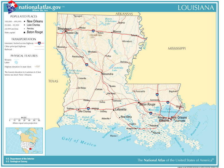
| תיאור | Louisiana map |
| מקור | Originally from Image%3ANational-atlas-louisiana.PNG. |
| יוצר |
רישיון
This map was obtained from an edition of the National Atlas of the United States. Like almost all works of the U.S. federal government, works from the National Atlas are in the public domain in the United States.
Online access: NationalAtlas.gov | 1970 print edition: Library of Congress, Perry-Castañeda Library
|
Wikipedia upload log
(All user names refer to en.wikipedia)
- 2004-11-05 01:28 Queson 778×584×8 (120201 bytes) National Atlas map of Louisiana {{PD-USGov}}
היסטוריית הקובץ
ניתן ללחוץ על תאריך/שעה כדי לראות את הקובץ כפי שנראה באותו זמן.
| תאריך/שעה | תמונה ממוזערת | ממדים | משתמש | הערה | |
|---|---|---|---|---|---|
| נוכחית | 15:05, 9 במאי 2007 | | 584 × 778 (117 ק"ב) | Hbk33 | {{Information |Description=en:Category:Louisiana maps |Source=Originally from [http://en.wikipedia.org en.wikipedia]; description page is/was [http://en.wikipedia.org/w/index.php?title=Image%3ANational-atlas-louisiana.PNG here]. |Date=2004-11-05 (ori |
שימוש בקובץ
הדף הבא משתמש בקובץ הזה:
שימוש גלובלי בקובץ
אתרי הוויקי השונים הבאים משתמשים בקובץ זה:
- שימוש באתר ar.wikipedia.org
- שימוש באתר en.wikivoyage.org
- שימוש באתר eu.wikipedia.org
- שימוש באתר fr.wikipedia.org
- שימוש באתר gu.wikipedia.org
- שימוש באתר hr.wiktionary.org
- שימוש באתר ja.wikipedia.org
- שימוש באתר kn.wikipedia.org
- שימוש באתר nl.wikipedia.org
- שימוש באתר pam.wikipedia.org
- שימוש באתר pl.wikivoyage.org
- שימוש באתר ro.wikipedia.org
- שימוש באתר sw.wikipedia.org
- שימוש באתר tr.wikipedia.org
- שימוש באתר zh-yue.wikipedia.org