
קובץ:Tephra fall from 1991 eruption of Mt Pinatubo.gif

אין גרסה ברזולוציה גבוהה יותר.
Tephra_fall_from_1991_eruption_of_Mt_Pinatubo.gif (600 × 425 פיקסלים, גודל הקובץ: 25 ק"ב, סוג MIME: image/gif)
| זהו קובץ שמקורו במיזם ויקישיתוף. תיאורו בדף תיאור הקובץ המקורי (בעברית) מוצג למטה. |
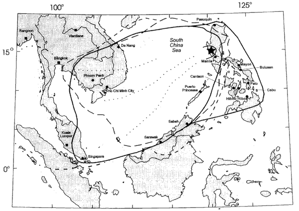
Area over which tephra from 1991 eruption of Mt Pinatubo fell.
This image is in the public domain in the United States because it only contains materials that originally came from the United States Geological Survey, an agency of the United States Department of the Interior. For more information, see the official USGS copyright policy.
|
היסטוריית הקובץ
ניתן ללחוץ על תאריך/שעה כדי לראות את הקובץ כפי שנראה באותו זמן.
| תאריך/שעה | תמונה ממוזערת | ממדים | משתמש | הערה | |
|---|---|---|---|---|---|
| נוכחית | 12:35, 8 במרץ 2006 | | 425 × 600 (25 ק"ב) | Magalhães | Area over which tephra from 1991 eruption of Mt Pinatubo fell. Source: [http://pubs.usgs.gov/pinatubo/paladio/fig9.gif Fig.9] on [http://pubs.usgs.gov/pinatubo/paladio]. {{PD-USGov-Interior-USGS}} |
שימוש בקובץ
הדף הבא משתמש בקובץ הזה:
שימוש גלובלי בקובץ
אתרי הוויקי השונים הבאים משתמשים בקובץ זה:
- שימוש באתר en.wikipedia.org
- שימוש באתר ja.wikipedia.org
- שימוש באתר nl.wikipedia.org
- שימוש באתר pam.wikipedia.org
- שימוש באתר uk.wikipedia.org
- שימוש באתר zh.wikipedia.org