מצר בויד
| מידע כללי | |
|---|---|
| מיקום |
מעבר דרייק |
| סוג |
מצר ים |
| מידות | |
| רוחב ממוצע |
40 ק"מ |
| מידע נוסף | |
| קואורדינטות | 62°50′00″S 62°00′00″W / 62.8333°S 62°W |
|
(למפת איי שטלנד הדרומיים רגילה) | |

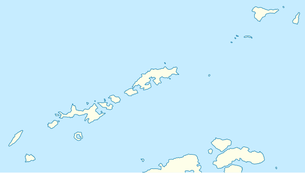
מצר בויד (באנגלית: Boyd Strait) הוא מצר ים שרוחבו 40 קילומטרים. המצר ממוקם בין האי סנואו, והאי סמית', באיי שטלנד הדרומיים, בטריטורייה הבריטית האנטארקטית, שבאנטארקטיקה[1][2].
המצר מקשר בין מעבר דרייק למצר ברנספילד.
היסטוריה[עריכת קוד מקור | עריכה]
מיפוי המצר[עריכת קוד מקור | עריכה]
המצר מופה לראשונה ב-26 באוקטובר 1823[2], על ידי משלחת החקר הבריטית בפיקודו של ג'יימס ודל[2][1].
המצר מופה בשנית בעונת המחקר (הקיץ האנטארקטי) 1930–1931[2].
מקור השם[עריכת קוד מקור | עריכה]
שמו של המצר ניתן לו בשנת 1823, על ידי ודל[1].
ודל קרא למצר על שמו של קפטן דייוויד בויד (David Boyd), מהצי המלכותי הבריטי[2][1]. ודל שירת תחת פיקודו של בויד, בהיותו על אוניית הוד מלכותו פיירפליי (HMS Firefly) בין השנים 1810–1811[2].
לקריאה נוספת[עריכת קוד מקור | עריכה]
• Domack, Eugene & Canals, Miquel & Weber, Michael & Camerlenghi, Angelo & Rebesco, Michele & Shevenell, Amelia & Leventer, Amy & Urgeles, Roger & Lavoie, Caroline & Yoon, H. & Yoo, Kyu-Cheul & Willmott Puig, Veronica & Lamy, F. & Kuhn, Gerhard & Rosenheim, Brad. (2013), Paleohistory of Antarctic Peninsula Ice Streams, Boyd Strait and Palmer Deep Outlet Systems – IODP targets using new drilling technology
• Jin, Young & Larter, Robert & Kim, Yeadong & Nam, Sang & Kim, Kyu. (2002), Post-subduction margin structures along Boyd Strait, Antarctic Peninsula, Tectonophysics. 346. 187-200. 10.1016/S0040-1951(01)00281-5
• M.A. Garcı́a, C.G. Castro, A.F. Rı́os, M.D. Doval, G. Rosón, D. Gomis, O. López, Water masses and distribution of physico-chemical properties in the Western Bransfield Strait and Gerlache Strait during Austral summer 1995/96, Deep Sea Research Part II: Topical Studies in Oceanography, Volume 49, Issues 4–5, 2002, Pages 585-602, ISSN 0967-0645, https://doi.org/10.1016/S0967-0645(01)00113-8
• C. Moffat and M. Meredith, Shelf–ocean exchange and hydrography west of the Antarctic Peninsula: a review, Philos Trans A Math Phys Eng Sci. 2018 Jun 28; 376(2122): 20170164. doi: 10.1098/rsta.2017.0164
• Jeffrey Evans, Julian A. Dowdeswell, Colm Ó Cofaigh, Late Quaternary submarine bedforms and ice‐sheet flow in Gerlache Strait and on the adjacent continental shelf, Antarctic Peninsula, Journal of Quaternary Science, Volume 19, Issue 4 May 2004, Pages 397-407, https://doi.org/10.1002/jqs.831
• Tamara Yegorova, Vladimir Bakhmutov, Tomasz Janik, and Marek Grad, Joint geophysical and petrological models for the lithosphere structure of the Antarctic Peninsula continental margin, Geophys. J. Int. (2011) 184, 90–110 doi: 10.1111/j.1365-246X.2010.04867.x
קישורים חיצוניים[עריכת קוד מקור | עריכה]
- מצר בויד באתר הסקר הגאולוגי של ארצות הברית
- מצר בויד באתר הגאזט האנטארקטי המשווה SCAR של ממשלת אוסטרליה
- תצלום לוויין של אזור המצר, תוך סימון אתרים נוספים באזור באתר copernix
- מפת אזור מצר בויד
- מצר בויד באתר marineregions
הערות שוליים[עריכת קוד מקור | עריכה]


