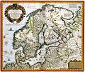
קובץ:Atlas Van der Hagen-KW1049B10 022-Tabula exactissima Regnorum SUECIAE et NORVEGIAE nec non MARIS UNIVERSI ORIENTALIS, Terrarumq- adjacentium summo studio ab.jpeg

גודל התצוגה המקדימה הזאת: 713 × 600 פיקסלים. רזולוציות אחרות: 285 × 240 פיקסלים | 571 × 480 פיקסלים | 913 × 768 פיקסלים | 1,218 × 1,024 פיקסלים | 2,435 × 2,048 פיקסלים | 5,500 × 4,626 פיקסלים.
לקובץ המקורי (5,500 × 4,626 פיקסלים, גודל הקובץ: 5.01 מ"ב, סוג MIME: image/jpeg)
היסטוריית הקובץ
ניתן ללחוץ על תאריך/שעה כדי לראות את הקובץ כפי שנראה באותו זמן.
| תאריך/שעה | תמונה ממוזערת | ממדים | משתמש | הערה | |
|---|---|---|---|---|---|
| נוכחית | 10:16, 19 ביולי 2015 |  | 4,626 × 5,500 (5.01 מ"ב) | OlafJanssen | GWToolset: Creating mediafile for OlafJanssen. |
שימוש בקובץ
הדפים הבאים משתמשים בקובץ הזה:
שימוש גלובלי בקובץ
אתרי הוויקי השונים הבאים משתמשים בקובץ זה:
- שימוש באתר ar.wikipedia.org
- اتحاد كالمار
- الإمبراطورية السويدية
- عصر الحرية (تاريخ السويد)
- تاريخ السويد
- عصر الفايكنج
- الاتحاد بين السويد والنرويج
- السويد خلال أواخر القرن التاسع عشر
- قالب:تاريخ السويد
- السويد خلال الحرب العالمية الأولى
- تاريخ السويد (1991-الآن)
- تاريخ السويد (1523-1611)
- تاريخ السويد (1611-1648)
- السويد خلال الاتحاد مع النرويج
- تاريخ السويد (1945-1967)
- שימוש באתר en.wikipedia.org
- History of Sweden
- List of wars involving Sweden
- Monarchy of Sweden
- Privy Council of Sweden
- Kingdom of Sweden (800–1521)
- History of Sweden (1523–1611)
- History of Sweden (1611–1648)
- Age of Liberty
- Gustavian era
- Sweden during the late 19th century
- Template:History of Sweden
- Industrialization of Sweden
- Sweden during World War II
- Wikipedia talk:Article series/Archive
- Vendel Period
- History of Sweden (1945–1967)
- Military history of Sweden
- User:Screensaver/Age of Liberty
- History of Sweden (1991–present)
- Prehistoric Sweden
- Timeline of Stockholm history
- Swedish Empire
- Sweden in Union with Norway
- History of Sweden (1967–1991)
- Economic history of Sweden
- User:༆/History of Europe templates
- LGBT history in Sweden
- Sweden during World War I
- List of years in Sweden
- Timeline of Gothenburg
- Timeline of Karlskoga
- שימוש באתר fi.wikipedia.org
- שימוש באתר ja.wikipedia.org
- שימוש באתר lt.wikipedia.org


