
קובץ:Erebus Ice Tongue - Antarctica.jpg

גודל התצוגה המקדימה הזאת: 800 × 599 פיקסלים. רזולוציות אחרות: 320 × 240 פיקסלים | 640 × 479 פיקסלים | 1,024 × 767 פיקסלים | 1,280 × 959 פיקסלים | 1,800 × 1,348 פיקסלים.
לקובץ המקורי (1,800 × 1,348 פיקסלים, גודל הקובץ: 660 ק"ב, סוג MIME: image/jpeg)
| זהו קובץ שמקורו במיזם ויקישיתוף. תיאורו בדף תיאור הקובץ המקורי (בעברית) מוצג למטה. |
תקציר
| תיאור |
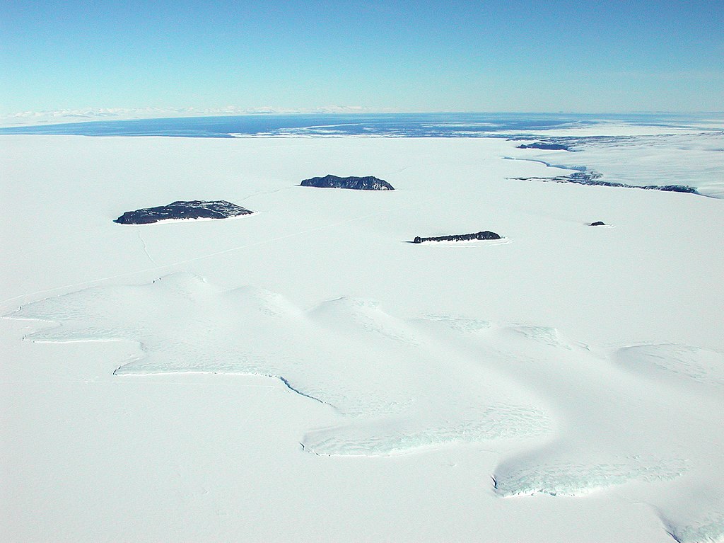
English: Aerial view of McMurdo Sound with Erebus Ice Tongue in the foreground and Ross Sea in the background, Antarctica. Français : Vue aérienne du détroit de Mc Murdo avec la glacier Erebus au premier plan et la mer de Ross au dernier plan, Antarctique. English: Original description: "An aerial view of the Erebus Ice Tongue in front of (left to right) Tent, Inaccessible, Big Razorback and Little Razorback islands. Cape Evans, a small rocky outcropping, can also be seen on the right. The white ice and snow surrounding the islands will thaw into open ocean water by late December. The ice edge and open water can be seen in the distance." |
| תאריך יצירה | |
| מקור | Antarctic Photo Library, U.S. Antarctic Program |
| יוצר | NSF/Josh Landis, employee 1999-2001 |
רישיון
| This image is a work of a National Science Foundation employee, taken or made as part of that person's official duties. As a work of the U.S. federal government, the image is in the public domain. |  |
היסטוריית הקובץ
ניתן ללחוץ על תאריך/שעה כדי לראות את הקובץ כפי שנראה באותו זמן.
| תאריך/שעה | תמונה ממוזערת | ממדים | משתמש | הערה | |
|---|---|---|---|---|---|
| נוכחית | 22:13, 13 במרץ 2007 | | 1,348 × 1,800 (660 ק"ב) | Eugene van der Pijll | Erebus Ice Tongue - Antarctica Source: Antarctic Photo Library, U.S. Antarctic Program [http://photolibrary.usap.gov/Portscripts/PortWeb.dll?query&field1=Filename&op1=matches&value=islandstongue.jpg&catalog=Antarctica&template=USAPgovMidThumbs] Photogra |
שימוש בקובץ
הדף הבא משתמש בקובץ הזה:
שימוש גלובלי בקובץ
אתרי הוויקי השונים הבאים משתמשים בקובץ זה:
- שימוש באתר ceb.wikipedia.org
- שימוש באתר de.wikipedia.org
- שימוש באתר en.wikipedia.org
- שימוש באתר es.wikipedia.org
- שימוש באתר fr.wikipedia.org
- שימוש באתר lt.wikipedia.org
- שימוש באתר nl.wikipedia.org
- שימוש באתר nn.wikipedia.org
- שימוש באתר uk.wikipedia.org
- שימוש באתר www.wikidata.org
- שימוש באתר zh.wikipedia.org