
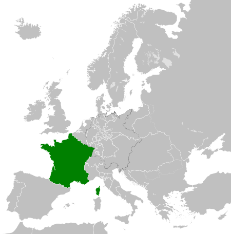
קובץ:French Kingdom within Europe 1839.svg

גודל התצוגה המקדימה הזאת מסוג PNG של קובץ ה־SVG הזה: 450 × 456 פיקסלים. רזולוציות אחרות: 237 × 240 פיקסלים | 474 × 480 פיקסלים | 758 × 768 פיקסלים | 1,011 × 1,024 פיקסלים | 2,021 × 2,048 פיקסלים.
לקובץ המקורי (קובץ SVG, הגודל המקורי: 450 × 456 פיקסלים, גודל הקובץ: 806 ק"ב)
| זהו קובץ שמקורו במיזם ויקישיתוף. תיאורו בדף תיאור הקובץ המקורי (בעברית) מוצג למטה. |
תקציר


.svg)
.svg)
.svg)
.svg)
.svg)


.svg)
.svg)
.svg)


.png)
.png)


.svg)


.svg)

.svg)


.svg)
.svg)
.svg)
.svg)


.svg)
.png)


.svg)


.svg)
.svg)


.svg)


.svg)


.svg)
.svg)
.svg)
.svg)
.svg)
.svg)
.svg)
_cropped.svg)
.svg)
.svg)
.svg)
.svg)
.svg)
.svg)
.svg)
.svg)
.svg)
.svg)
.svg)
.svg)
.svg)
.svg)
.svg)
.svg)
.svg)
.svg)
.svg)
.svg)
.svg)
.svg)
.svg)
.svg)
.svg)
.svg)
.svg)
.svg)
.svg)
.svg)
.svg)
.svg)
.svg)
.svg)
.svg)
.svg)
.svg)
.svg)
.svg)
.svg)
.svg)
.svg)
.svg)
.svg)
.svg)
רישיון
אני, בעל זכויות היוצרים על עבודה זו, מפרסם בזאת את העבודה תחת הרישיון הבא:
הקובץ הזה מתפרסם לפי תנאי רישיון קריאייטיב קומונז ייחוס-שיתוף זהה 4.0 בין־לאומי.
- הנכם רשאים:
- לשתף – להעתיק, להפיץ ולהעביר את העבודה
- לערבב בין עבודות – להתאים את העבודה
- תחת התנאים הבאים:
- ייחוס – יש לתת ייחוס הולם, לתת קישור לרישיון, ולציין אם נעשו שינויים. אפשר לעשות את זה בכל צורה סבירה, אבל לא בשום צורה שמשתמע ממנה שמעניק הרישיון תומך בך או בשימוש שלך.
- שיתוף זהה – אם תיצרו רמיקס, תשנו, או תבנו על החומר, חובה עליכם להפיץ את התרומות שלך לפי תנאי רישיון זהה או תואם למקור.
היסטוריית הקובץ
ניתן ללחוץ על תאריך/שעה כדי לראות את הקובץ כפי שנראה באותו זמן.
| תאריך/שעה | תמונה ממוזערת | ממדים | משתמש | הערה | |
|---|---|---|---|---|---|
| נוכחית | 08:33, 31 במאי 2016 | | 456 × 450 (806 ק"ב) | Alphathon | Minor corrections (Tarasp and post-181 German Confederation border change) |
| 10:47, 14 ביולי 2015 |  | 456 × 450 (754 ק"ב) | Elevatorrailfan | User created page with UploadWizard |
שימוש בקובץ
הדפים הבאים משתמשים בקובץ הזה:
שימוש גלובלי בקובץ
אתרי הוויקי השונים הבאים משתמשים בקובץ זה:
- שימוש באתר azb.wikipedia.org
- שימוש באתר az.wikipedia.org
- שימוש באתר bn.wikipedia.org
- שימוש באתר ca.wikipedia.org
- שימוש באתר cs.wikipedia.org
- שימוש באתר el.wikipedia.org
- שימוש באתר en.wikipedia.org
- שימוש באתר eo.wikipedia.org
- שימוש באתר es.wikipedia.org
- שימוש באתר et.wikipedia.org
- שימוש באתר fa.wikipedia.org
- שימוש באתר fi.wikipedia.org
- שימוש באתר fr.wikipedia.org
- שימוש באתר hi.wikipedia.org
- שימוש באתר hr.wikipedia.org
- שימוש באתר id.wikipedia.org
- שימוש באתר is.wikipedia.org
- שימוש באתר it.wikipedia.org
- שימוש באתר ja.wikipedia.org
- שימוש באתר ka.wikipedia.org
- שימוש באתר ko.wikipedia.org
- שימוש באתר lv.wikipedia.org
- שימוש באתר mk.wikipedia.org
- שימוש באתר mt.wikipedia.org
- שימוש באתר nl.wikipedia.org
- שימוש באתר pnb.wikipedia.org
- שימוש באתר pt.wikipedia.org
- שימוש באתר ru.wikipedia.org
- שימוש באתר simple.wikipedia.org
- שימוש באתר sl.wikipedia.org
- שימוש באתר sq.wikipedia.org
- שימוש באתר sr.wikipedia.org
- שימוש באתר th.wikipedia.org
- שימוש באתר tr.wikipedia.org