
קובץ:GooseneckMeandersUtahAerial1.jpg

גודל התצוגה המקדימה הזאת: 800 × 597 פיקסלים. רזולוציות אחרות: 320 × 239 פיקסלים | 640 × 477 פיקסלים | 1,024 × 764 פיקסלים | 1,280 × 955 פיקסלים | 2,560 × 1,910 פיקסלים | 3,757 × 2,803 פיקסלים.
לקובץ המקורי (3,757 × 2,803 פיקסלים, גודל הקובץ: 5.99 מ"ב, סוג MIME: image/jpeg)
| זהו קובץ שמקורו במיזם ויקישיתוף. תיאורו בדף תיאור הקובץ המקורי (בעברית) מוצג למטה. |
תקציר
| תיאור |
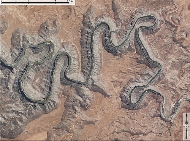
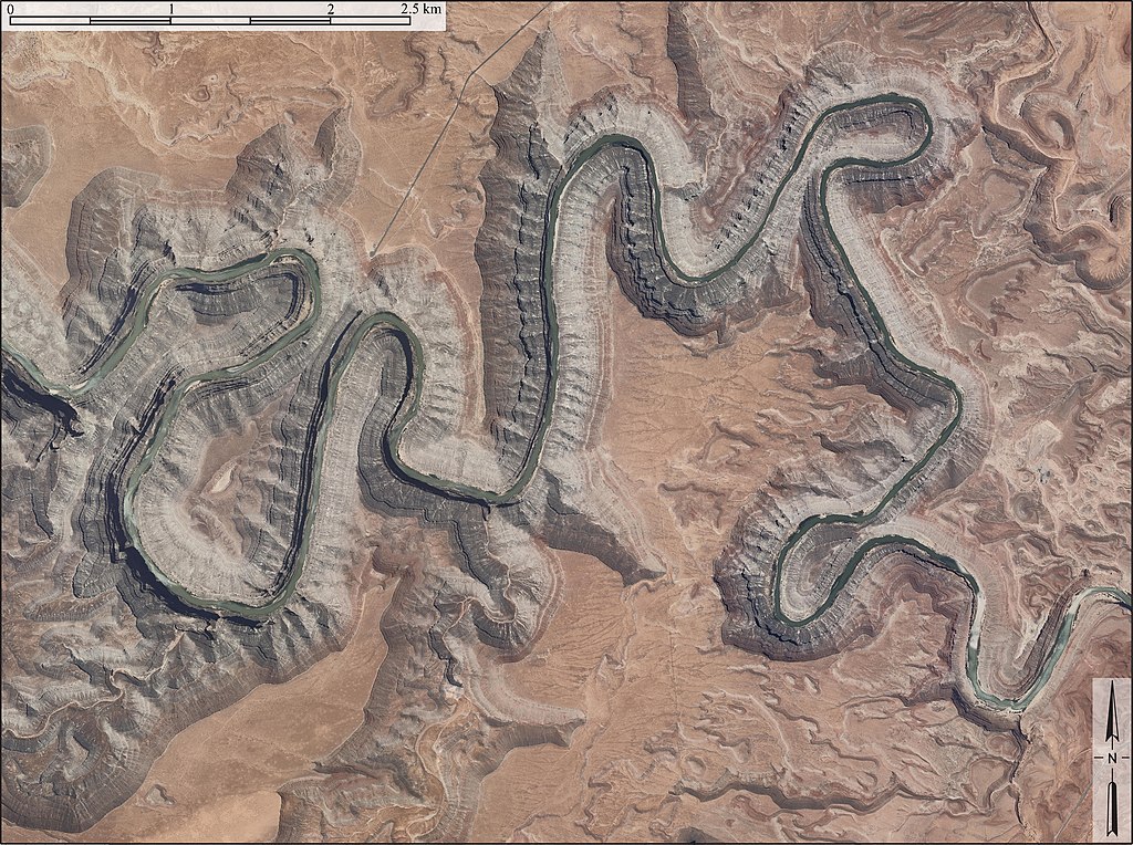
English: Aerial image of entrenched meanders of the San Juan River within Goosenecks State Park.
|
| תאריך יצירה | צולם ב- 10 במאי 2011 |
| מקור | USDA/FSA |
| יוצר | USDA/FSA |
רישיון
This work is in the public domain in the United States because it is a work prepared by an officer or employee of the United States Government as part of that person’s official duties under the terms of Title 17, Chapter 1, Section 105 of the US Code.
Note: This only applies to original works of the Federal Government and not to the work of any individual U.S. state, territory, commonwealth, county, municipality, or any other subdivision. This template also does not apply to postage stamp designs published by the United States Postal Service since 1978. (See § 313.6(C)(1) of Compendium of U.S. Copyright Office Practices). It also does not apply to certain US coins; see The US Mint Terms of Use.
|
 | |
| הקובץ הזה זוהה כקובץ חופשי מכל מגבלה ידועה תחת חוק זכויות היוצרים, כולל כל הזכויות הקשורות והסמוכות. | ||
היסטוריית הקובץ
ניתן ללחוץ על תאריך/שעה כדי לראות את הקובץ כפי שנראה באותו זמן.
| תאריך/שעה | תמונה ממוזערת | ממדים | משתמש | הערה | |
|---|---|---|---|---|---|
| נוכחית | 17:08, 10 במאי 2011 | | 2,803 × 3,757 (5.99 מ"ב) | Cristellaria |
שימוש בקובץ
הדף הבא משתמש בקובץ הזה:
שימוש גלובלי בקובץ
אתרי הוויקי השונים הבאים משתמשים בקובץ זה:
- שימוש באתר ceb.wikipedia.org
- שימוש באתר de.wikipedia.org
- שימוש באתר en.wikipedia.org
- שימוש באתר en.wikivoyage.org
- שימוש באתר fr.wikipedia.org
- שימוש באתר it.wikipedia.org
- שימוש באתר pl.wikipedia.org
- שימוש באתר www.wikidata.org