
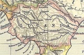
קובץ:Lucania map.jpg

לקובץ המקורי (910 × 598 פיקסלים, גודל הקובץ: 222 ק"ב, סוג MIME: image/jpeg)
| זהו קובץ שמקורו במיזם ויקישיתוף. תיאורו בדף תיאור הקובץ המקורי (בעברית) מוצג למטה. |
| תיאור | ||||||
| תאריך יצירה | ||||||
| מקור | File:Shepherd-c-030-031.jpg | |||||
| יוצר |
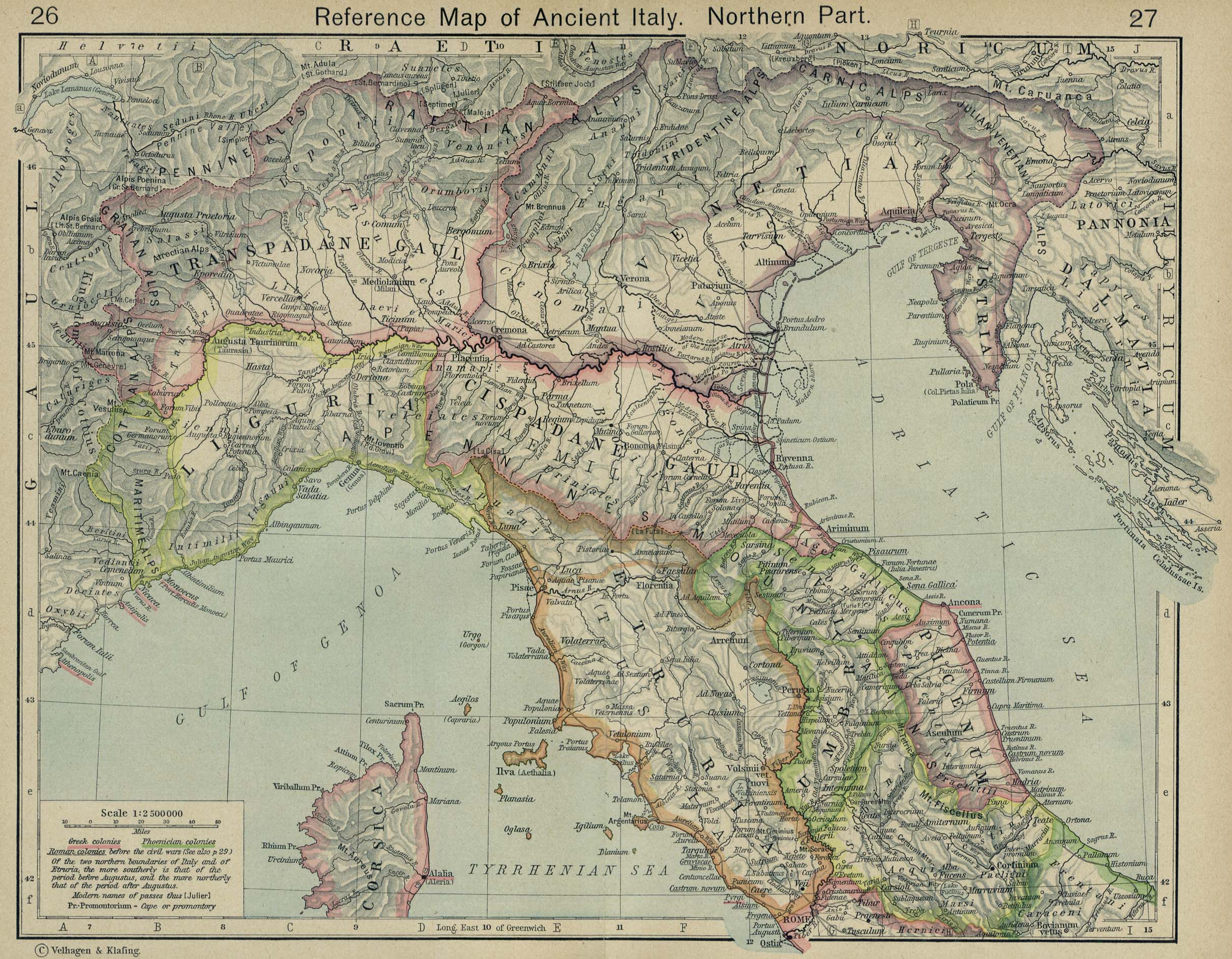
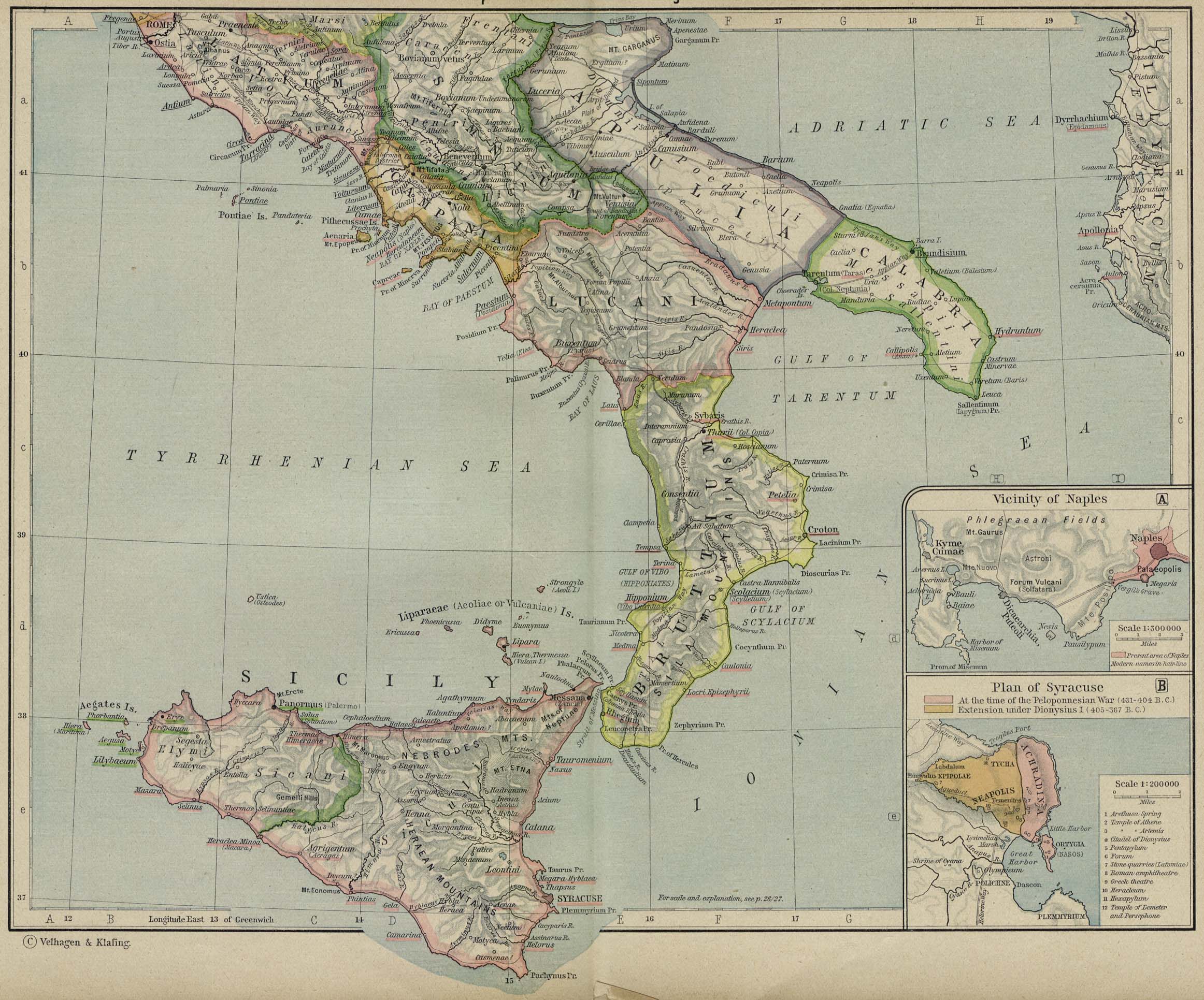
Historical Atlas by William R. Shepherd 1911 edition
Reference: Reference Map of Ancient Italy, Southern Part Courtesy of the University of Texas Libraries, The University of Texas at Austin. [1] |
|||||
| אישורים והיתרים (שימוש חוזר בקובץ זה) |
|
|||||
| גרסאות אחרות | ||||||
היסטוריית הקובץ
ניתן ללחוץ על תאריך/שעה כדי לראות את הקובץ כפי שנראה באותו זמן.
| תאריך/שעה | תמונה ממוזערת | ממדים | משתמש | הערה | |
|---|---|---|---|---|---|
| נוכחית | 16:36, 2 בפברואר 2018 | | 598 × 910 (222 ק"ב) | HerrAdams | Reverted to version as of 14:57, 2 November 2014 (UTC); removed border |
| 18:03, 2 בנובמבר 2014 |  | 624 × 936 (243 ק"ב) | Cristiano64 | outer edge in black | |
| 18:02, 2 בנובמבר 2014 |  | 624 × 936 (243 ק"ב) | Cristiano64 | outer edge in black | |
| 17:57, 2 בנובמבר 2014 |  | 598 × 910 (222 ק"ב) | Cristiano64 | File more clear. It was too dark | |
| 11:57, 12 בדצמבר 2006 |  | 423 × 704 (97 ק"ב) | Roke~commonswiki | Map of Lucania, cropped from old public domain map of Italy, from the Perry-Castañeda Library Map Collection, Historical Atlas by William R. Shepherd [http://www.lib.utexas.edu/maps/historical/shepherd/italy_ancient_north.jpg north], [http://www.lib.utex |
שימוש בקובץ
הדף הבא משתמש בקובץ הזה:
שימוש גלובלי בקובץ
אתרי הוויקי השונים הבאים משתמשים בקובץ זה:
- שימוש באתר ar.wikipedia.org
- שימוש באתר be.wikipedia.org
- שימוש באתר bg.wikipedia.org
- שימוש באתר bs.wikipedia.org
- שימוש באתר ca.wikipedia.org
- שימוש באתר cs.wikipedia.org
- שימוש באתר el.wikipedia.org
- שימוש באתר en.wikipedia.org
- שימוש באתר es.wikipedia.org
- שימוש באתר eu.wikipedia.org
- שימוש באתר fa.wikipedia.org
- שימוש באתר fi.wikipedia.org
- שימוש באתר fr.wikipedia.org
- שימוש באתר fr.wiktionary.org
- שימוש באתר hr.wikipedia.org
- שימוש באתר id.wikipedia.org
- שימוש באתר it.wikipedia.org
- שימוש באתר ko.wikipedia.org
- שימוש באתר lmo.wikipedia.org
- שימוש באתר pl.wiktionary.org
- שימוש באתר pt.wikipedia.org
- שימוש באתר ru.wikipedia.org
- שימוש באתר scn.wikipedia.org
- שימוש באתר sh.wikipedia.org
- שימוש באתר sk.wikipedia.org