
קובץ:Map of Afghanistan, Districts and Provinces.svg

גודל התצוגה המקדימה הזאת מסוג PNG של קובץ ה־SVG הזה: 750 × 475 פיקסלים. רזולוציות אחרות: 320 × 203 פיקסלים | 640 × 405 פיקסלים | 1,024 × 649 פיקסלים | 1,280 × 811 פיקסלים | 2,560 × 1,621 פיקסלים.
לקובץ המקורי (קובץ SVG, הגודל המקורי: 750 × 475 פיקסלים, גודל הקובץ: 2.57 מ"ב)
| זהו קובץ שמקורו במיזם ויקישיתוף. תיאורו בדף תיאור הקובץ המקורי (בעברית) מוצג למטה. |
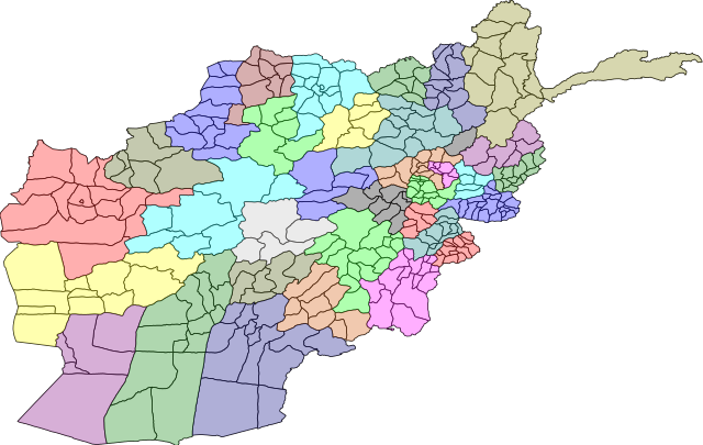
| תיאור | A map of the districts of Afghanistan. The districts are colour grouped by province. | |||||
| תאריך יצירה | ||||||
| מקור |
Map originally from Maplibrary.org who in turn have extracted it from GADM version 0.9 which source the data for Afghanistan as comming from the USGS.
|
|||||
| יוצר | USGS and Lokal_Profil | |||||
| אישורים והיתרים (שימוש חוזר בקובץ זה) |
|
|||||
| גרסאות אחרות |
|


היסטוריית הקובץ
ניתן ללחוץ על תאריך/שעה כדי לראות את הקובץ כפי שנראה באותו זמן.
| תאריך/שעה | תמונה ממוזערת | ממדים | משתמש | הערה | |
|---|---|---|---|---|---|
| נוכחית | 23:31, 1 במרץ 2009 | | 475 × 750 (2.57 מ"ב) | Lokal Profil | {{Information |Description=A map of the districts of Afghanistan. The districts are colour grouped by province. |Source=Map originally from [http://www.maplibrary.org/stacks/gadm/AFG/index.php Maplibrary.org] who in turn have extracted it from [http://bio |
שימוש בקובץ
הדפים הבאים משתמשים בקובץ הזה:
- אורוזגאן
- באדגיס
- באמיאן
- בגלאן (מחוז)
- בדח'שאן
- בלח' (מחוז)
- ג'וזג'אן
- גור (מחוז)
- דאיכונדי
- הלמנד (מחוז)
- הראת (מחוז)
- זאבול
- ח'וסת (מחוז)
- כאפיסא
- כונר
- לגמאן
- לוגר (מחוז)
- מחוזות אפגניסטן
- מיידאן ורדכ
- נורסתאן
- נימרוז
- ננגרהאר
- סמנגאן
- סר-י פול (מחוז)
- ע'זני (מחוז)
- פאריאב
- פכתיא
- פכתיכא
- פנג'שיר
- פראה (מחוז)
- פרוואן
- קאבול (מחוז)
- קונדוז (מחוז)
- קנדהאר (מחוז)
- תח'אר
- תבנית:מחוזות אפגניסטן
שימוש גלובלי בקובץ
אתרי הוויקי השונים הבאים משתמשים בקובץ זה:
- שימוש באתר de.wikipedia.org
- שימוש באתר eo.wikipedia.org
- שימוש באתר hi.wikipedia.org
- बदख़्शान प्रान्त
- बादग़ीस प्रान्त
- बग़लान प्रान्त
- बल्ख़ प्रान्त
- दायकुंदी प्रान्त
- फ़ारयाब प्रान्त
- फ़राह प्रान्त
- हेलमंद प्रान्त
- काबुल प्रान्त
- कापीसा प्रान्त
- कुनर प्रान्त
- कुंदुज़ प्रान्त
- लग़मान प्रान्त
- लोगर प्रान्त
- नंगरहार प्रान्त
- नीमरूज़ प्रान्त
- नूरिस्तान प्रान्त
- ओरूज़्गान प्रान्त
- पकतिया प्रान्त
- पकतीका प्रान्त
- पंजशीर प्रान्त
- परवान प्रान्त
- समंगान प्रान्त
- सर-ए-पोल प्रान्त
- तख़ार प्रान्त
- मैदान वरदक प्रान्त
- ज़ाबुल प्रान्त
- साँचा:अफ़ग़ानिस्तान के प्रांत
- ग़ोर प्रान्त
- अफ़ग़ानिस्तान के प्रांत
- साँचा:अफगानिस्तान के प्रांत
- मजार शरीफ
- कुंदोज
- जलालाबाद, अफगानिस्तान
- सरेपोल
- साँचा:अफगानिस्तान
- बाल्टिस्तान
- उदयान
- अराकोशिया
- हराएवा
- बामयान प्रान्त
- ग़ज़नी प्रान्त
- हेरात प्रान्त
- जोज़जान प्रान्त
- ख़ोस्त प्रान्त
- कांधार प्रान्त