
קובץ:Newriverwatershed-1-.jpg

גודל התצוגה המקדימה הזאת: 464 × 599 פיקסלים. רזולוציות אחרות: 186 × 240 פיקסלים | 372 × 480 פיקסלים | 595 × 768 פיקסלים | 793 × 1,024 פיקסלים | 1,415 × 1,826 פיקסלים.
לקובץ המקורי (1,415 × 1,826 פיקסלים, גודל הקובץ: 511 ק"ב, סוג MIME: image/jpeg)
| זהו קובץ שמקורו במיזם ויקישיתוף. תיאורו בדף תיאור הקובץ המקורי (בעברית) מוצג למטה. |
תקציר
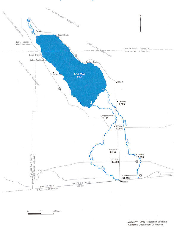
| תיאור |
Map of the New River — in Imperial County, Southern California.
|
| תאריך יצירה | |
| מקור | Department of Water Resources |
| יוצר | DWR |
| אישורים והיתרים (שימוש חוזר בקובץ זה) |
Public use |


רישיון

|
The copyright holder of this work allows anyone to use it for any purpose including unrestricted redistribution, commercial use, and modification.
Usage notes:
|
היסטוריית הקובץ
ניתן ללחוץ על תאריך/שעה כדי לראות את הקובץ כפי שנראה באותו זמן.
| תאריך/שעה | תמונה ממוזערת | ממדים | משתמש | הערה | |
|---|---|---|---|---|---|
| נוכחית | 12:29, 20 במאי 2006 | | 1,826 × 1,415 (511 ק"ב) | Cnrc | {{Information| |Description=From Mexicali to the Salton Sea, Communities Are at Risk Surface water in the New River is contaminated with metals, pesticides, VOC's, and bacteria. Pathogenic viruses have also been reported in the New River. Human exposur |
שימוש בקובץ
הדף הבא משתמש בקובץ הזה:
שימוש גלובלי בקובץ
אתרי הוויקי השונים הבאים משתמשים בקובץ זה:
- שימוש באתר ar.wikipedia.org
- שימוש באתר arz.wikipedia.org
- שימוש באתר ceb.wikipedia.org
- שימוש באתר de.wikipedia.org
- שימוש באתר en.wikipedia.org
- שימוש באתר eo.wikipedia.org
- שימוש באתר es.wikipedia.org
- שימוש באתר fr.wikipedia.org
- שימוש באתר ja.wikipedia.org
- שימוש באתר ml.wikipedia.org
- שימוש באתר pt.wikipedia.org
- שימוש באתר ru.wikipedia.org
- שימוש באתר simple.wikipedia.org
- שימוש באתר www.wikidata.org