
קובץ:Rashi map of Israel.jpg
לקובץ המקורי (4,774 × 6,215 פיקסלים, גודל הקובץ: 3.29 מ"ב, סוג MIME: image/jpeg)
| זהו קובץ שמקורו במיזם ויקישיתוף. תיאורו בדף תיאור הקובץ המקורי (בעברית) מוצג למטה. |
תקציר
| כותר |
Angliae, Scotiae, Et Hiberniae, Sive Britannicar: Insularum Descriptio [cartographic material]. |
|||||||||||||||||||||||
| תיאור |
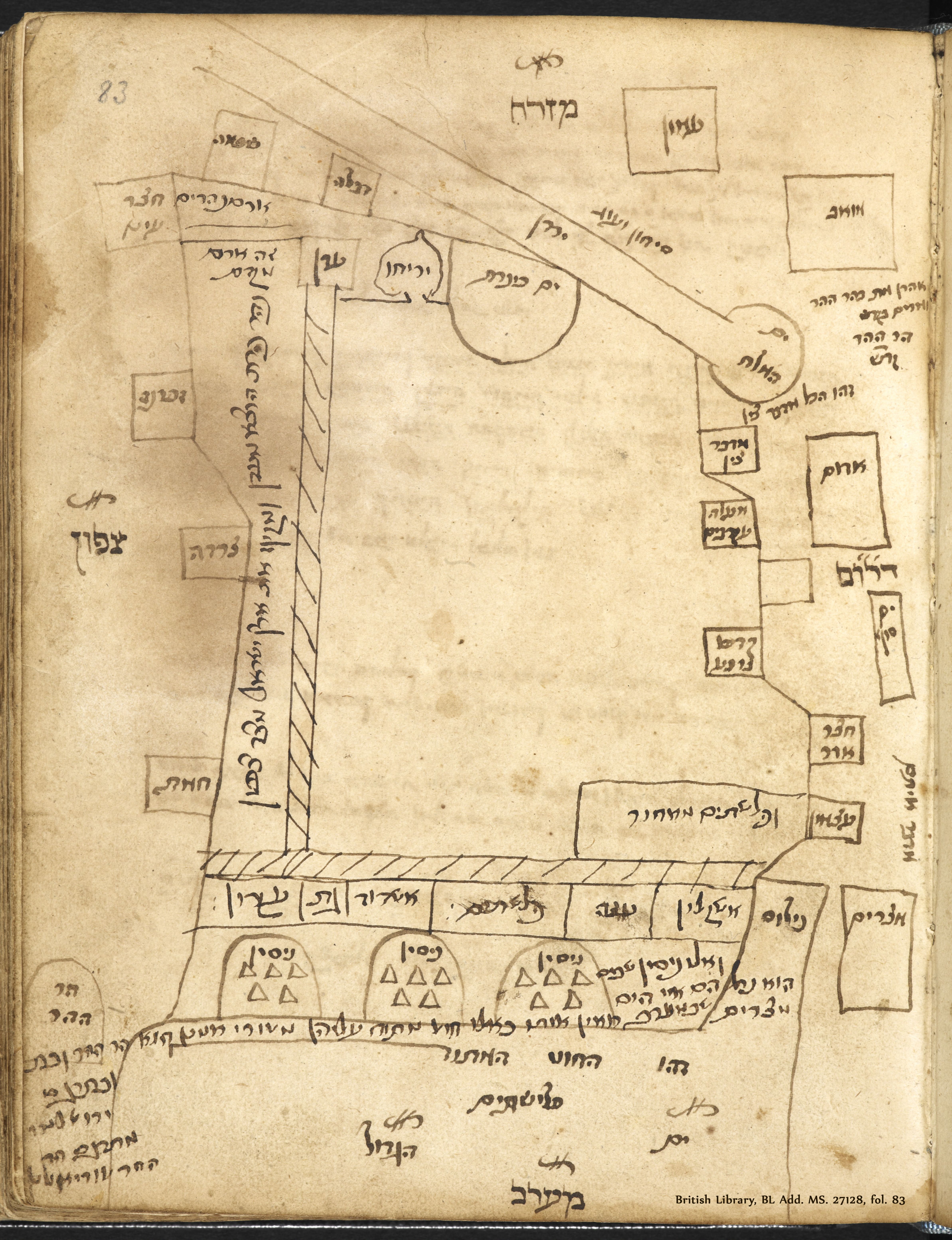
English: Map of Eretz Israel created by Rashi, Digital image of the original in The British Library, BL Add. MS. 27128, fol. 83.
The British Library London England Add. 27128, fol. 83.
עברית: מפת ארץ ישראל לפי רש"י, סריקה של המפה שנמצאת בספרייה הבריטית, BL Add. MS. 27128, fol. 83 |
|||||||||||||||||||||||
| תאריך יצירה | unknown | |||||||||||||||||||||||
| מקור | National Library of Israel | |||||||||||||||||||||||
| יוצר |
|
|||||||||||||||||||||||
| ייחוס | אוסף המפות ע"ש ערן לאור | |||||||||||||||||||||||
| Georeferencing | If inappropriate please set warp_status = skip to hide. | |||||||||||||||||||||||
| Archival data | ||||||||||||||||||||||||
| אוסף |
|
|||||||||||||||||||||||
| ממדים | 376x500x540 mm | |||||||||||||||||||||||

רישיון
|
עבודת אמנות דו-מימדית זו המוצגת בתמונה שוחררה לרשות הציבור בכל העולם בעקבות תאריך מותו של היוצר, או תאריך פרסום היצירה. לפיכך, תצלום היצירה גם הוא ברשות הציבור.
הודעה זו תקפה לגבי התצלומים שנוצרו בארצות הברית, בגרמניה ובמדינות רבות נוספות.
| ||||
היסטוריית הקובץ
ניתן ללחוץ על תאריך/שעה כדי לראות את הקובץ כפי שנראה באותו זמן.
| תאריך/שעה | תמונה ממוזערת | ממדים | משתמש | הערה | |
|---|---|---|---|---|---|
| נוכחית | 14:58, 21 ביולי 2022 | | 6,215 × 4,774 (3.29 מ"ב) | Shimon.tre | == {{int:filedesc}} == {{map |Title=Angliae, Scotiae, Et Hiberniae, Sive Britannicar: Insularum Descriptio [cartographic material]. |Description= {{en|1=Map of Eretz Israel created by Rashi, Digital image of the original in The British Library, BL Add. MS. 27128, fol. 83. The British Library London England Add. 27128, fol. 83.}} {{he|1=מפת ארץ ישראל לפי רש"י, סריקה של המפה שנמצאת בספרייה הבריטית, BL Add. MS. 27128, fol. 83 }} |Dimensions = 376x500x540 mm |Source=[https://www.nli.org.il/he/ma... |
שימוש בקובץ
הדפים הבאים משתמשים בקובץ הזה: