
קובץ:Tularosa-Basin-NM-USGS-map opaque.gif
גודל התצוגה המקדימה הזאת: 447 × 599 פיקסלים. רזולוציות אחרות: 179 × 240 פיקסלים | 624 × 836 פיקסלים.
לקובץ המקורי (624 × 836 פיקסלים, גודל הקובץ: 59 ק"ב, סוג MIME: image/gif)
| זהו קובץ שמקורו במיזם ויקישיתוף. תיאורו בדף תיאור הקובץ המקורי (בעברית) מוצג למטה. |
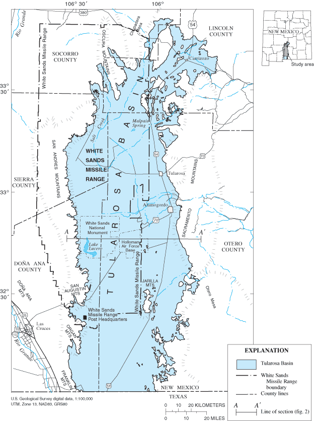
| תיאור | Location map of Tularosa Basin 2004. Huff, Glenn F. (2005) "Simulation of Ground-Water Flow in the Basin-Fill Aquifer of the Tularosa Basin, South-Central New Mexico, Predevelopment through 2040" Scientific Investigations Report 2004-5197, United States Geological Survey, Washongton, D.C., fig. 1. | |||
| תאריך יצירה | ||||
| מקור |
USGS (https://pubs.er.usgs.gov/usgspubs/sir/sir20045197) http://pubs.usgs.gov/sir/2004/5197/ http://pubs.usgs.gov/sir/2004/5197/images/fig1.gif |
|||
| יוצר | Huff, Glenn F. (United States Geological Survey) | |||
| אישורים והיתרים (שימוש חוזר בקובץ זה) |
|
|||
| גרסאות אחרות | Image:Tularosa-Basin-NM-USGS-map.gif (transparent version) |
היסטוריית הקובץ
ניתן ללחוץ על תאריך/שעה כדי לראות את הקובץ כפי שנראה באותו זמן.
| תאריך/שעה | תמונה ממוזערת | ממדים | משתמש | הערה | |
|---|---|---|---|---|---|
| נוכחית | 15:50, 11 בדצמבר 2007 | | 836 × 624 (59 ק"ב) | AnonMoos | actual opaque version |
| 08:55, 7 באוקטובר 2007 |  | 836 × 624 (61 ק"ב) | Balmung0731 | {{Information |Description=Location map of Tularosa Basin 2004. Huff, Glenn F. (2005) "Simulation of Ground-Water Flow in the Basin-Fill Aquifer of the Tularosa Basin, South-Central New Mexico, Predevelopment through 2040" Scientific Investigations Report |
שימוש בקובץ
הדפים הבאים משתמשים בקובץ הזה:
שימוש גלובלי בקובץ
אתרי הוויקי השונים הבאים משתמשים בקובץ זה:
- שימוש באתר bg.wikipedia.org
- שימוש באתר en.wikipedia.org
- שימוש באתר fa.wikipedia.org
- שימוש באתר fr.wikipedia.org
- שימוש באתר hu.wikipedia.org
- שימוש באתר ko.wikipedia.org
- שימוש באתר ru.wikipedia.org
- שימוש באתר sv.wikipedia.org
- שימוש באתר uk.wikipedia.org
- שימוש באתר vi.wikipedia.org
- שימוש באתר www.wikidata.org
- שימוש באתר zh.wikipedia.org