
קובץ:Chicagoland Map.svg

גודל התצוגה המקדימה הזאת מסוג PNG של קובץ ה־SVG הזה: 365 × 599 פיקסלים. רזולוציות אחרות: 146 × 240 פיקסלים | 292 × 480 פיקסלים | 468 × 768 פיקסלים | 624 × 1,024 פיקסלים | 1,247 × 2,048 פיקסלים | 2,082 × 3,418 פיקסלים.
לקובץ המקורי (קובץ SVG, הגודל המקורי: 2,082 × 3,418 פיקסלים, גודל הקובץ: 362 ק"ב)
| זהו קובץ שמקורו במיזם ויקישיתוף. תיאורו בדף תיאור הקובץ המקורי (בעברית) מוצג למטה. |
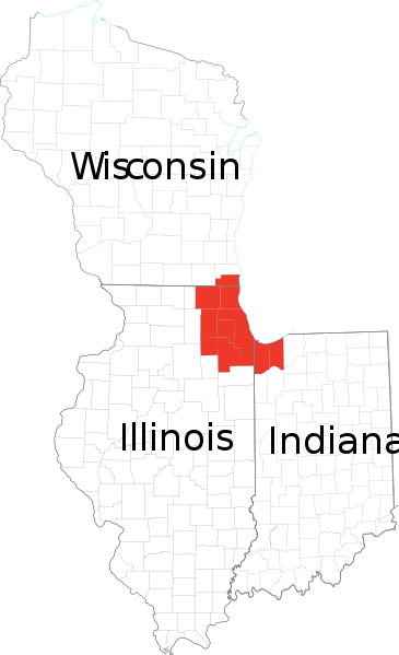
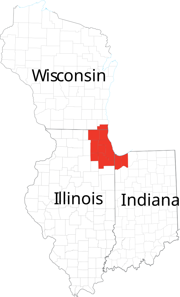
| תיאור | Derived from maps obtained from [1]. Combined in en:Adobe Illustrator and exported to SVG. | |||
| מקור | ||||
| יוצר | ||||
| אישורים והיתרים (שימוש חוזר בקובץ זה) |
|
היסטוריית הקובץ
ניתן ללחוץ על תאריך/שעה כדי לראות את הקובץ כפי שנראה באותו זמן.
| תאריך/שעה | תמונה ממוזערת | ממדים | משתמש | הערה | |
|---|---|---|---|---|---|
| נוכחית | 16:41, 24 בפברואר 2007 | | 3,418 × 2,082 (362 ק"ב) | Ocuish | {{Information |Description=Derived from maps obtained from [http://nationalatlas.gov/printable/reference.html]. Combined in en:Adobe Illustrator and exported to SVG. en:Category:Illinois mapsen:Category:Indiana maps[[:en:Category:Wisconsi |
שימוש בקובץ
![]() אין בוויקיפדיה דפים המשתמשים בקובץ זה.
אין בוויקיפדיה דפים המשתמשים בקובץ זה.
שימוש גלובלי בקובץ
אתרי הוויקי השונים הבאים משתמשים בקובץ זה:
- שימוש באתר cs.wikipedia.org
- שימוש באתר en.wikipedia.org
- שימוש באתר fr.wikipedia.org
- שימוש באתר ja.wikipedia.org
- שימוש באתר ko.wikipedia.org
- שימוש באתר ru.wikipedia.org
- שימוש באתר tr.wikipedia.org
- שימוש באתר vi.wikipedia.org