
קובץ:Galveston Bay Landsat.jpg
אין גרסה ברזולוציה גבוהה יותר.
Galveston_Bay_Landsat.jpg (368 × 464 פיקסלים, גודל הקובץ: 33 ק"ב, סוג MIME: image/jpeg)
| זהו קובץ שמקורו במיזם ויקישיתוף. תיאורו בדף תיאור הקובץ המקורי (בעברית) מוצג למטה. |
תקציר
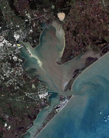
| תיאור |
English: Trinity Bay, (above), and Galveston Bay, in southeast Texas.
|
| תאריך יצירה | |
| מקור | Houston, Texas at the Wayback Machine |
| יוצר | United States Geological Survey |
| גרסאות אחרות |

רישיון
This image is in the public domain in the United States because it only contains materials that originally came from the United States Geological Survey, an agency of the United States Department of the Interior. For more information, see the official USGS copyright policy.
|
יומן העלאה מקורי
הועבר מ- en.wikipedia לוויקישיתוףעל ידי Ronhjones.
תיאור הקובץ המקורי נמצא כאן. כל שמות המשתמשים הבאים מתייחסים ל-en.wikipedia.
Upload date | User | Bytes | Dimensions | Comment
- 2009-10-15 04:15 (UTC) | Mcorazao | 23150 (bytes) | 247×322 | Author: United States Geological Service http://landsat.usgs.gov/gallery/detail/370/ This image is a clipped version of a satellite shot of the Houston area (clipping by M. Corazao)
היסטוריית הקובץ
ניתן ללחוץ על תאריך/שעה כדי לראות את הקובץ כפי שנראה באותו זמן.
| תאריך/שעה | תמונה ממוזערת | ממדים | משתמש | הערה | |
|---|---|---|---|---|---|
| נוכחית | 13:12, 3 בספטמבר 2017 | | 464 × 368 (33 ק"ב) | Ras67 | higher resolution, losslessly cropped from the original |
| 02:43, 3 בינואר 2012 |  | 322 × 247 (23 ק"ב) | Ronhjones | (Original text) : Author: United States Geological Service http://landsat.usgs.gov/gallery/detail/370/ This image is a clipped version of a satellite shot of the Houston area (clipping by M. Corazao) |
שימוש בקובץ
הדף הבא משתמש בקובץ הזה:
שימוש גלובלי בקובץ
אתרי הוויקי השונים הבאים משתמשים בקובץ זה:
- שימוש באתר ca.wikipedia.org
- שימוש באתר ceb.wikipedia.org
- שימוש באתר de.wikipedia.org
- שימוש באתר en.wikipedia.org
- שימוש באתר es.wikipedia.org
- שימוש באתר fa.wikipedia.org
- שימוש באתר fi.wikipedia.org
- שימוש באתר fr.wikipedia.org
- שימוש באתר ja.wikipedia.org
- שימוש באתר lt.wikipedia.org
- שימוש באתר pt.wikipedia.org
- שימוש באתר www.wikidata.org