
קובץ:Santa Rosa and San Jacinto Mountains 283.jpg

גודל התצוגה המקדימה הזאת: 800 × 600 פיקסלים. רזולוציות אחרות: 320 × 240 פיקסלים | 640 × 480 פיקסלים | 1,024 × 768 פיקסלים | 1,280 × 960 פיקסלים | 1,600 × 1,200 פיקסלים.
לקובץ המקורי (1,600 × 1,200 פיקסלים, גודל הקובץ: 902 ק"ב, סוג MIME: image/jpeg)
| זהו קובץ שמקורו במיזם ויקישיתוף. תיאורו בדף תיאור הקובץ המקורי (בעברית) מוצג למטה. |
| תיאור |
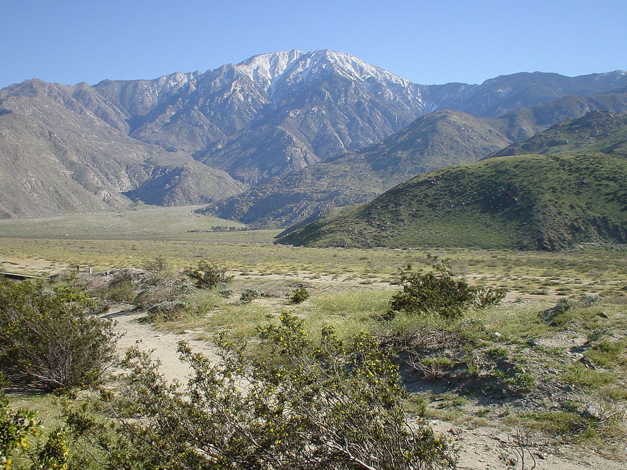
English: The North face of San Jacinto Mountains, the northernmost of the Peninsular Ranges, in Riverside County, Southern California.
|
| תאריך יצירה | |
| מקור | en-WP: Image:?? 283.jpg |
| יוצר | en:user:Geographer |
| אישורים והיתרים (שימוש חוזר בקובץ זה) |
הקובץ הזה מתפרסם לפי תנאי רישיון קריאייטיב קומונז ייחוס 1.0 כללי.
|
היסטוריית הקובץ
ניתן ללחוץ על תאריך/שעה כדי לראות את הקובץ כפי שנראה באותו זמן.
| תאריך/שעה | תמונה ממוזערת | ממדים | משתמש | הערה | |
|---|---|---|---|---|---|
| נוכחית | 15:46, 30 בספטמבר 2008 | | 1,200 × 1,600 (902 ק"ב) | H-stt | {{Information |Description= Santa Rosa and San Jacinto Mountains National Monument, California, USA. North face of San Jacinto Mountains, on March 30, 2003. The steep escarpment of its north face climbs over 10,000 feet (3 km) in 7 miles (11.3 km). It is |
שימוש בקובץ
הדף הבא משתמש בקובץ הזה:
שימוש גלובלי בקובץ
אתרי הוויקי השונים הבאים משתמשים בקובץ זה:
- שימוש באתר arz.wikipedia.org
- שימוש באתר ceb.wikipedia.org
- שימוש באתר cs.wikipedia.org
- שימוש באתר de.wikipedia.org
- שימוש באתר en.wikipedia.org
- List of mountains of the United States
- San Jacinto Peak
- San Jacinto Mountains
- Santa Rosa and San Jacinto Mountains National Monument
- List of national monuments of the United States
- List of mountain peaks of California
- Protected areas of California
- Riverside County, California
- Geography of southern California
- שימוש באתר en.wikivoyage.org
- שימוש באתר es.wikipedia.org
- Anexo:Montañas de Estados Unidos
- Anexo:Unidades del Sistema de Conservación de Paisajes Nacionales (EE.UU.)
- Anexo:Monumentos nacionales de Estados Unidos
- Sierra de San Jacinto
- Anexo:Cadenas montañosas más largas de la Tierra
- Anexo:Picos ultraprominentes del mundo
- Anexo:Montañas destacadas de América del Norte (con Centroamérica)
- שימוש באתר et.wikipedia.org
- שימוש באתר eu.wikipedia.org
- שימוש באתר fr.wikipedia.org
- שימוש באתר id.wikipedia.org
- שימוש באתר it.wikipedia.org
- שימוש באתר ja.wikipedia.org
- שימוש באתר ml.wikipedia.org
- שימוש באתר pt.wikipedia.org
- שימוש באתר ru.wikipedia.org
- שימוש באתר simple.wikipedia.org
- שימוש באתר sw.wikipedia.org
- שימוש באתר uk.wikipedia.org
- שימוש באתר ur.wikipedia.org
- שימוש באתר vi.wikipedia.org
- שימוש באתר www.wikidata.org
- שימוש באתר zh.wikipedia.org