
קובץ:1800 Wilkinson Map of the 4 Eastern Churches rectified.jpg

לקובץ המקורי (1,678 × 1,308 פיקסלים, גודל הקובץ: 895 ק"ב, סוג MIME: image/jpeg)
| זהו קובץ שמקורו במיזם ויקישיתוף. תיאורו בדף תיאור הקובץ המקורי (בעברית) מוצג למטה. |
| תיאור |
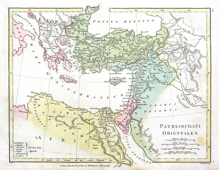
English: Map of the 4 Eastern Churches in the Pentarchy, circa 500CE |
| תאריך יצירה | (UTC) |
| מקור | |
| יוצר |
מעלה היצירה המקורי היה Fredrick Wilhelm מוויקיפדיה האנגלית
|
| זוהי תמונה מרוטשת, זאת אומרת שהתמונה שונתה בצורה דיגיטלית מהמקור. Modifications: Rectified, cropped, colors corrected. את התמונה המקורית ניתן לראות ב: 1800 Wilkinson Map of the 4 Eastern Churches.jpg. השינוי בוצע על ידי MichaelBueker.
|
|
יצירה זו נמצאת בנחלת הכלל במדינת המקור ובמדינות אחרות בהם תקופת זכויות היוצרים היא משך חיי היוצר ו-70 שנה (או פחות) מפטירתו.
| |
| הקובץ הזה זוהה כקובץ חופשי מכל מגבלה ידועה תחת חוק זכויות היוצרים, כולל כל הזכויות הקשורות והסמוכות. | |
יומן העלאה מקורי
This image is a derivative work of the following images:
- File:1800_Wilkinson_Map_of_the_4_Eastern_Churches.jpg licensed with Cc-pd-mark-footer, PD-old
- 2010-08-24T08:50:03Z File Upload Bot (Magnus Manske) 1802x1378 (2039705 Bytes) {{BotMoveToCommons|en.wikipedia|year={{subst:CURRENTYEAR}}|month={{subst:CURRENTMONTHNAME}}|day={{subst:CURRENTDAY}}}} {{Information |Description={{en|Map of the 4 Eastern Churches in the Pentarchy, circa 500CE}} |Source=Tra
Uploaded with derivativeFX
היסטוריית הקובץ
ניתן ללחוץ על תאריך/שעה כדי לראות את הקובץ כפי שנראה באותו זמן.
| תאריך/שעה | תמונה ממוזערת | ממדים | משתמש | הערה | |
|---|---|---|---|---|---|
| נוכחית | 23:47, 10 בפברואר 2016 | | 1,308 × 1,678 (895 ק"ב) | Чръный человек | обработка |
| 21:04, 9 בפברואר 2016 |  | 1,308 × 1,678 (1.22 מ"ב) | Чръный человек | Осветление | |
| 23:29, 1 במאי 2011 |  | 1,308 × 1,678 (1.91 מ"ב) | MichaelBueker | color touchup | |
| 23:14, 1 במאי 2011 |  | 1,308 × 1,678 (1.61 מ"ב) | MichaelBueker | {{Information |Description={{en|Map of the 4 Eastern Churches in the Pentarchy, circa 500CE}} |Source=*File:1800_Wilkinson_Map_of_the_4_Eastern_Churches.jpg |Date=2011-05-01 20:13 (UTC) |Author=*[[:File:1800_Wilkinson_Map_of_the_4_Eastern_Churches.j |
שימוש בקובץ
![]() אין בוויקיפדיה דפים המשתמשים בקובץ זה.
אין בוויקיפדיה דפים המשתמשים בקובץ זה.
שימוש גלובלי בקובץ
אתרי הוויקי השונים הבאים משתמשים בקובץ זה:
- שימוש באתר ar.wikipedia.org
- שימוש באתר arz.wikipedia.org
- שימוש באתר az.wikipedia.org
- שימוש באתר bg.wikipedia.org
- שימוש באתר bn.wikipedia.org
- שימוש באתר ckb.wikipedia.org
- שימוש באתר cs.wikipedia.org
- שימוש באתר el.wikipedia.org
- שימוש באתר en.wikipedia.org
- שימוש באתר eo.wikipedia.org
- שימוש באתר es.wikipedia.org
- שימוש באתר fa.wikipedia.org
- שימוש באתר fr.wikipedia.org
- שימוש באתר hu.wikipedia.org
- שימוש באתר id.wikipedia.org
- שימוש באתר it.wikipedia.org
- שימוש באתר ko.wikipedia.org
- שימוש באתר mk.wikipedia.org
- שימוש באתר ml.wikipedia.org
- שימוש באתר pt.wikipedia.org
- שימוש באתר ru.wikipedia.org
- שימוש באתר sk.wikipedia.org
- שימוש באתר sr.wikipedia.org
- שימוש באתר sv.wikipedia.org
- שימוש באתר tr.wikipedia.org
- שימוש באתר uk.wikipedia.org