
קובץ:Karst following phosphate mining on Nauru.jpg
גודל התצוגה המקדימה הזאת: 800 × 535 פיקסלים. רזולוציות אחרות: 320 × 214 פיקסלים | 640 × 428 פיקסלים | 1,024 × 684 פיקסלים | 1,280 × 855 פיקסלים | 1,787 × 1,194 פיקסלים.
לקובץ המקורי (1,787 × 1,194 פיקסלים, גודל הקובץ: 835 ק"ב, סוג MIME: image/jpeg)
| זהו קובץ שמקורו במיזם ויקישיתוף. תיאורו בדף תיאור הקובץ המקורי (בעברית) מוצג למטה. |
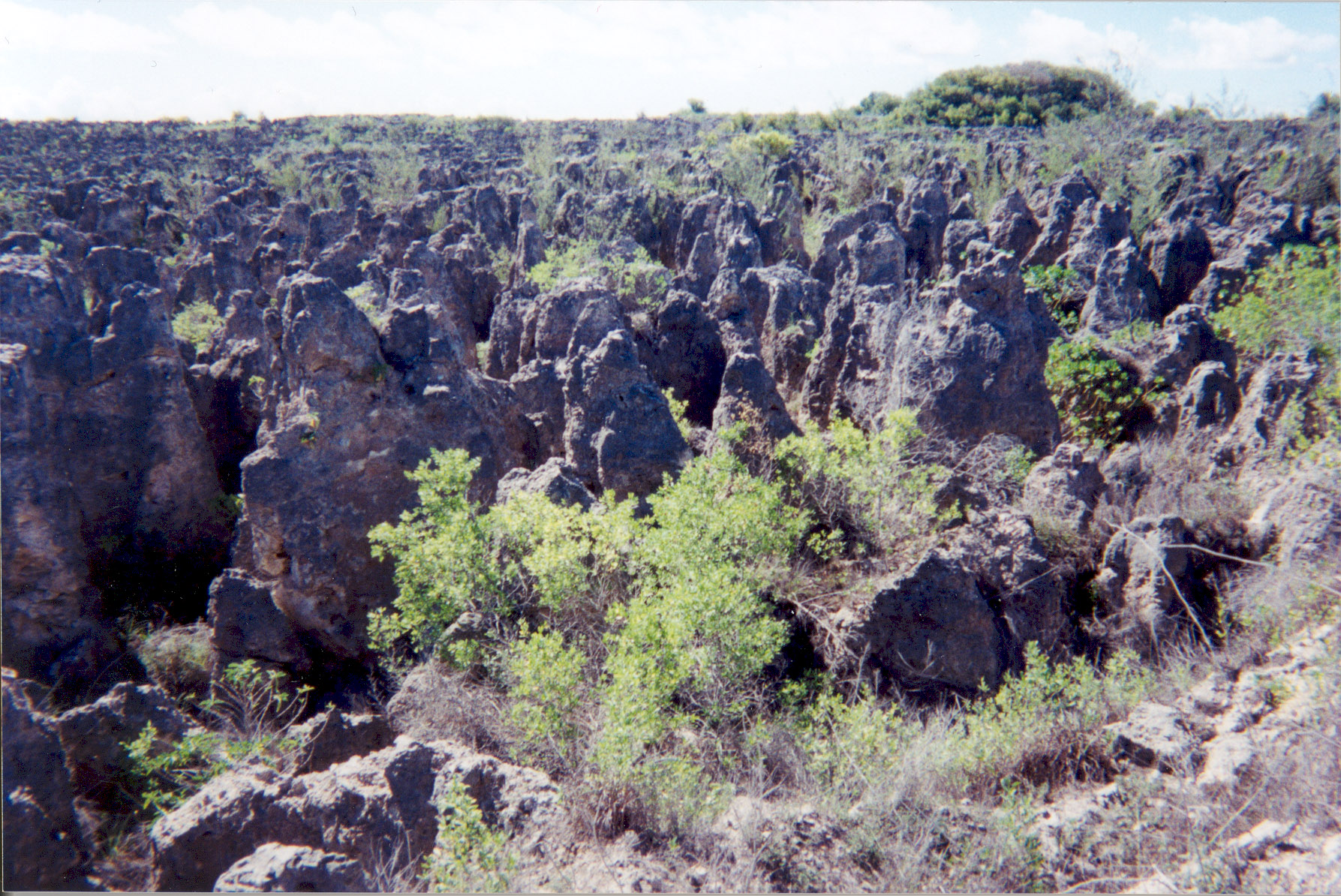
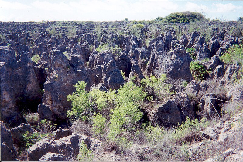
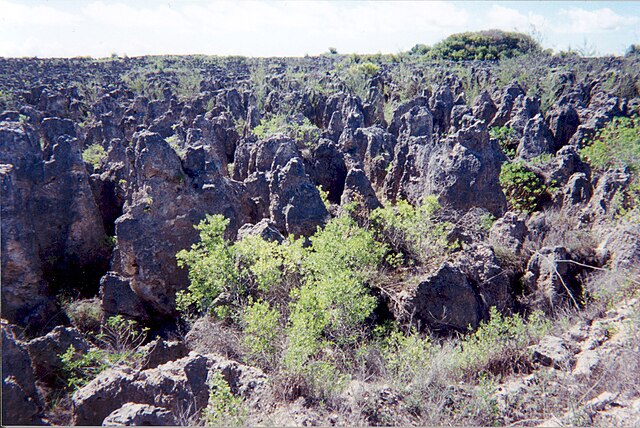
A limestone karst on Nauru Island as a result of the over-mining of phosphate.
Source: [1] (http://www.arm.gov/)
This photograph was produced by the Atmospheric Radiation Measurement Program.
Their site states:
|
היסטוריית הקובץ
ניתן ללחוץ על תאריך/שעה כדי לראות את הקובץ כפי שנראה באותו זמן.
| תאריך/שעה | תמונה ממוזערת | ממדים | משתמש | הערה | |
|---|---|---|---|---|---|
| נוכחית | 05:10, 3 באפריל 2007 | | 1,194 × 1,787 (835 ק"ב) | Indolences | |
| 08:21, 5 במאי 2006 |  | 321 × 480 (75 ק"ב) | PDH | Nauruan districts of Denigomodu and Nibok. ''Courtesy: U.S. Department of Energy's Atmospheric Radiation Measurement Program.'' Source: [http://images.arm.gov/armimages.nsf/a89ad461c472386388256cf3007aeb57/500d8248a90eea9488256cc400727e96?OpenDocument&H |
שימוש בקובץ
הדף הבא משתמש בקובץ הזה:
שימוש גלובלי בקובץ
אתרי הוויקי השונים הבאים משתמשים בקובץ זה:
- שימוש באתר az.wikipedia.org
- שימוש באתר bg.wikipedia.org
- שימוש באתר bh.wikipedia.org
- שימוש באתר ca.wikipedia.org
- שימוש באתר de.wikipedia.org
- שימוש באתר el.wikipedia.org
- שימוש באתר en.wikipedia.org
- שימוש באתר en.wikiquote.org
- שימוש באתר eo.wikipedia.org
- שימוש באתר es.wikipedia.org
- שימוש באתר eu.wikipedia.org
- שימוש באתר fa.wikipedia.org
- שימוש באתר fr.wikipedia.org
- שימוש באתר ha.wikipedia.org
- שימוש באתר id.wikipedia.org
- שימוש באתר ig.wikipedia.org
- שימוש באתר ja.wikipedia.org
- שימוש באתר mk.wikipedia.org
- שימוש באתר mt.wikipedia.org
- שימוש באתר na.wikipedia.org
- שימוש באתר new.wikipedia.org
- שימוש באתר pl.wikipedia.org
- שימוש באתר pt.wikipedia.org
- שימוש באתר ro.wikipedia.org
- שימוש באתר ru.wikipedia.org
- שימוש באתר si.wikipedia.org
- שימוש באתר sv.wikipedia.org
- שימוש באתר tr.wikipedia.org
- שימוש באתר uk.wikipedia.org
- שימוש באתר vi.wikipedia.org