
קובץ:Somers Isles Map - John Speed 1676.jpg
לקובץ המקורי (2,744 × 1,781 פיקסלים, גודל הקובץ: 2.86 מ"ב, סוג MIME: image/jpeg)
| זהו קובץ שמקורו במיזם ויקישיתוף. תיאורו בדף תיאור הקובץ המקורי (בעברית) מוצג למטה. |
תקציר
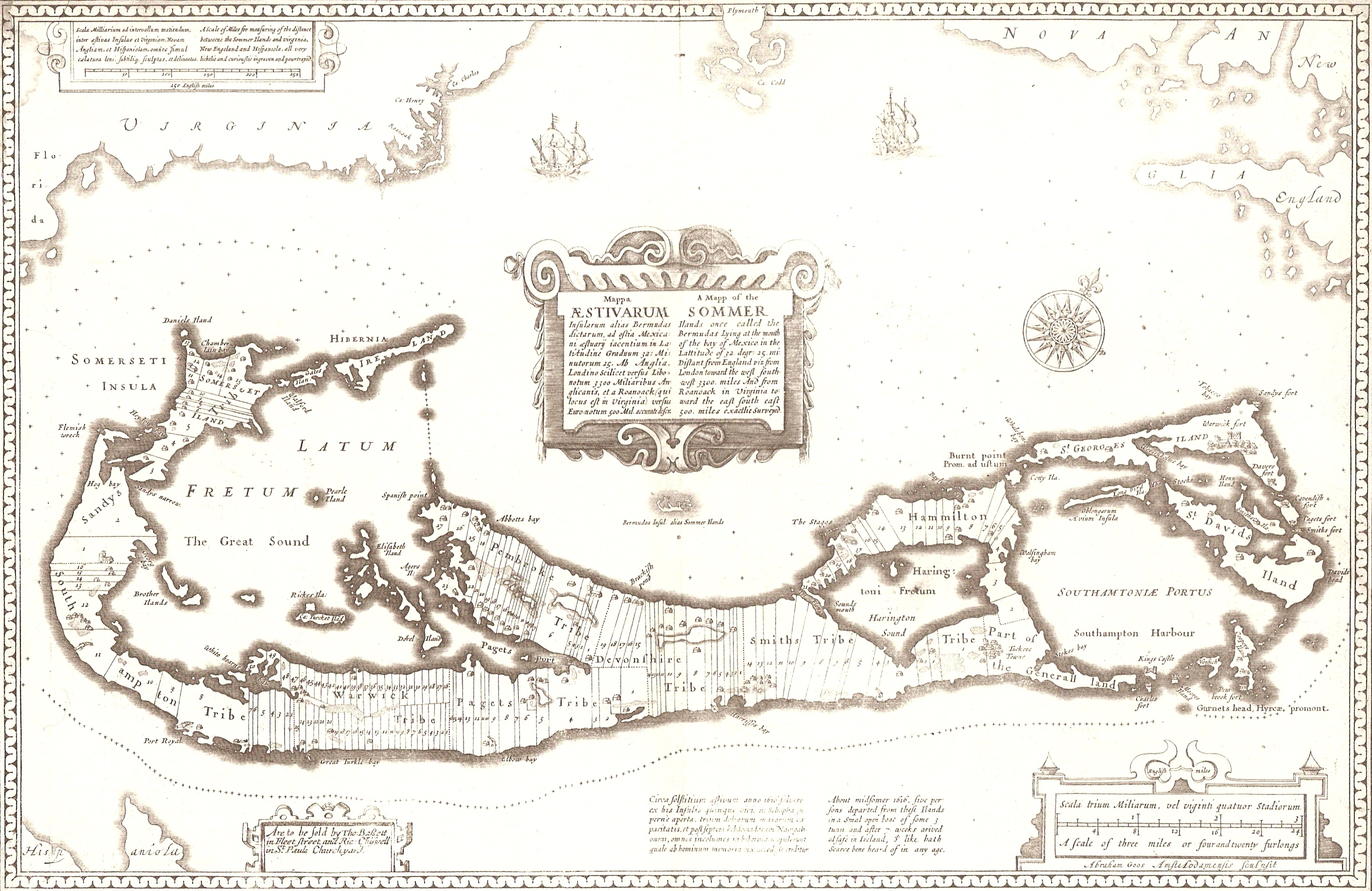
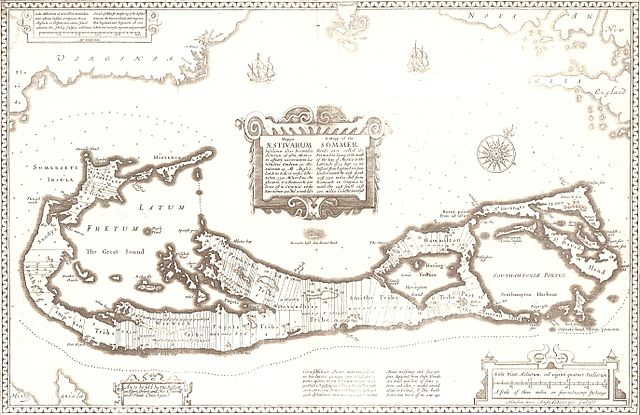
A 1676 map of the Somers Isles (alias Bermuda), by John Speed (based on the map of surveyor Richard Norwood). Clearly shown are the tribe roads cut parallel through the forest between the North and South Shores (except in St. Georges, the eastern-most subdivision, comprising the islands of St. George's and St. David's, the South-Eastern tip of the Main Island, and the various smaller islands between. This was general land, and not commercial.
Aodhdubh 06:04, 26 February 2007 (UTC)
רישיון
|
יצירה זו נמצאת בנחלת הכלל במדינת המקור ובמדינות אחרות בהם תקופת זכויות היוצרים היא משך חיי היוצר ו-70 שנה (או פחות) מפטירתו.
| |
| הקובץ הזה זוהה כקובץ חופשי מכל מגבלה ידועה תחת חוק זכויות היוצרים, כולל כל הזכויות הקשורות והסמוכות. | |
היסטוריית הקובץ
ניתן ללחוץ על תאריך/שעה כדי לראות את הקובץ כפי שנראה באותו זמן.
| תאריך/שעה | תמונה ממוזערת | ממדים | משתמש | הערה | |
|---|---|---|---|---|---|
| נוכחית | 09:04, 26 בפברואר 2007 | | 1,781 × 2,744 (2.86 מ"ב) | Aodhdubh | A 1676 map of the Somers Isles (alias Bermuda), by John Speed (based on the map of surveyor Richard Norwood). Clearly shown are the tribe roads cut parallel through the forest between the North and South Shores (except in St. Georges, the eastern-most sub |
שימוש בקובץ
הדף הבא משתמש בקובץ הזה:
שימוש גלובלי בקובץ
אתרי הוויקי השונים הבאים משתמשים בקובץ זה:
- שימוש באתר de.wikipedia.org
- שימוש באתר en.wikipedia.org
- שימוש באתר tr.wikipedia.org