
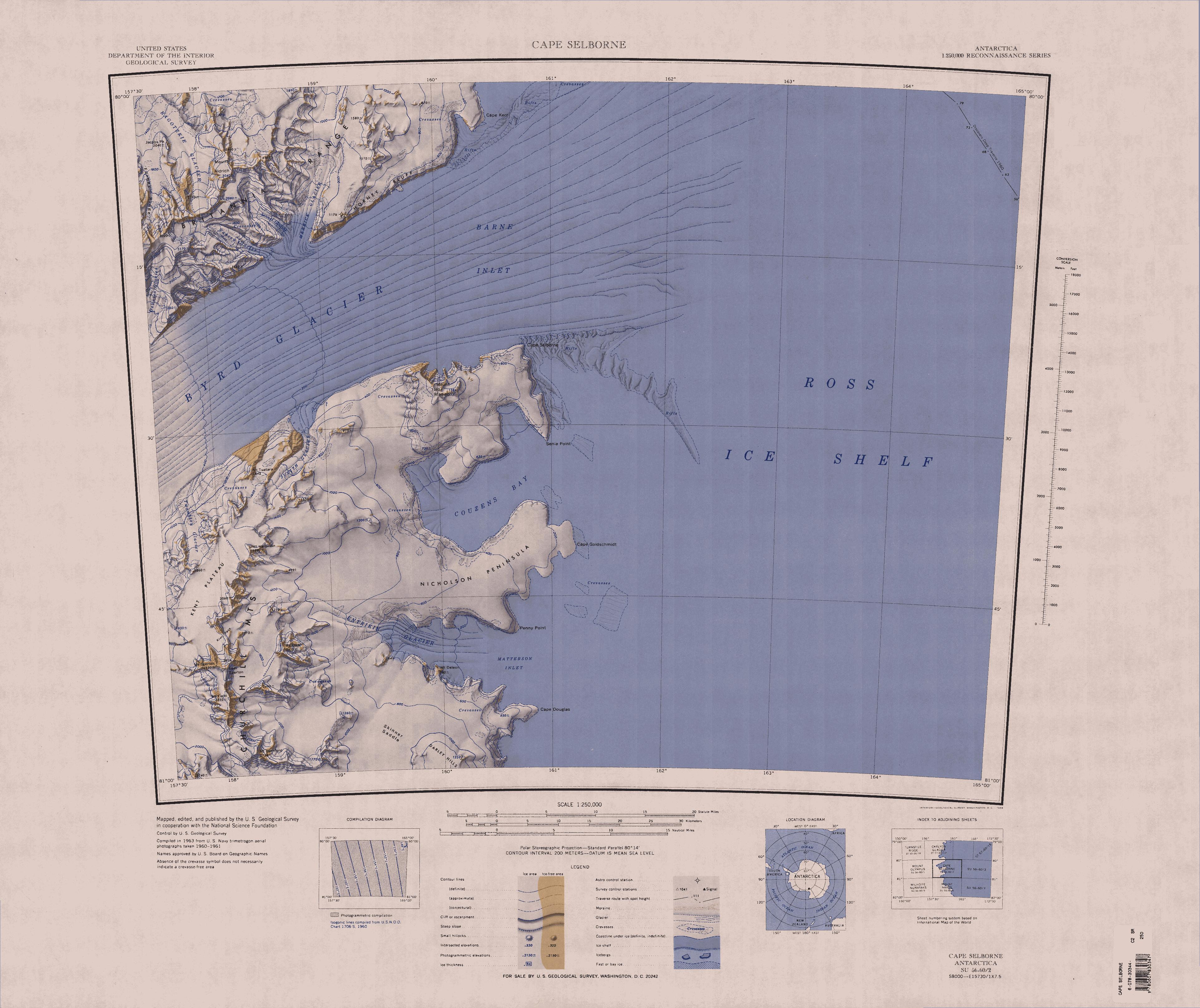
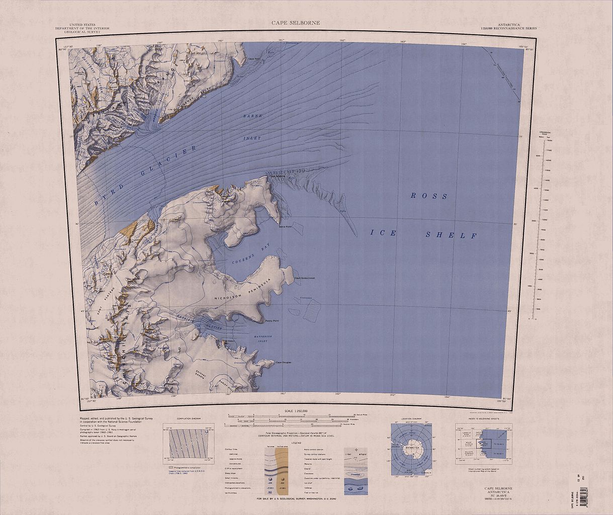
קובץ:C80195s1 Ant.Map Cape Selborne.jpg
גודל התצוגה המקדימה הזאת: 714 × 600 פיקסלים. רזולוציות אחרות: 286 × 240 פיקסלים | 572 × 480 פיקסלים | 914 × 768 פיקסלים | 1,219 × 1,024 פיקסלים | 2,438 × 2,048 פיקסלים | 3,848 × 3,232 פיקסלים.
לקובץ המקורי (3,848 × 3,232 פיקסלים, גודל הקובץ: 1.44 מ"ב, סוג MIME: image/jpeg)
| זהו קובץ שמקורו במיזם ויקישיתוף. תיאורו בדף תיאור הקובץ המקורי (בעברית) מוצג למטה. |
| תיאור |
English: Map of Antarctica by the United States Antarctic Resource Center of the US Geological Society. |
| מקור | USGS |
| יוצר | USGS |
This image is in the public domain in the United States because it only contains materials that originally came from the United States Geological Survey, an agency of the United States Department of the Interior. For more information, see the official USGS copyright policy.
|
היסטוריית הקובץ
ניתן ללחוץ על תאריך/שעה כדי לראות את הקובץ כפי שנראה באותו זמן.
| תאריך/שעה | תמונה ממוזערת | ממדים | משתמש | הערה | |
|---|---|---|---|---|---|
| נוכחית | 22:17, 3 באפריל 2005 | | 3,232 × 3,848 (1.44 מ"ב) | Achim Raschka | Map of Antarctica by the United States Antarctic Ressource Center of the US Geological Society. {{PD-US}} Copyrights and Trademarks USGS-authored or produced data and information are in the public domain. While the content of most USGS web pages is in th |
שימוש בקובץ
הדפים הבאים משתמשים בקובץ הזה:
שימוש גלובלי בקובץ
אתרי הוויקי השונים הבאים משתמשים בקובץ זה:
- שימוש באתר bg.wikipedia.org
- שימוש באתר ceb.wikipedia.org
- שימוש באתר de.wikipedia.org
- Byrd-Gletscher
- Churchill Mountains
- Kap Selborne
- Mount Hamilton (Churchill Mountains)
- Kent-Plateau
- Kiwi-Pass
- Penny Point
- Nicholson-Halbinsel
- Senia Point
- Kap Goldschmidt
- Mount Deleon
- Entrikin-Gletscher
- Britannia Range
- Ragotzkie-Gletscher
- Barne Inlet
- Kap Kerr
- Hillary-Küste
- Shackleton-Küste
- Borowski Peak
- Diskussion:Borowski Peak
- Yancey-Gletscher
- Horney Bluff
- Judith-Gletscher
- Mount Madison
- Cornwell Corner
- DeVries-Gletscher
- Mount Dick (Antarktika)
- Jacobs Peak
- Skinner Saddle
- שימוש באתר en.wikipedia.org
- שימוש באתר es.wikipedia.org
- שימוש באתר hu.wikipedia.org
- שימוש באתר it.wikipedia.org