
קובץ:Map indicating McClure Strait, Northwest Territories, Canada.png
אין גרסה ברזולוציה גבוהה יותר.
Map_indicating_McClure_Strait,_Northwest_Territories,_Canada.png (420 × 380 פיקסלים, גודל הקובץ: 59 ק"ב, סוג MIME: image/png)
| זהו קובץ שמקורו במיזם ויקישיתוף. תיאורו בדף תיאור הקובץ המקורי (בעברית) מוצג למטה. |
תקציר
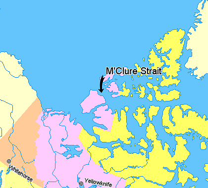
Map indicating McClure Strait (M'Clure Strait), Northwest Territories, Canada.
Nunavut
Northwest Territories
Yukon Territory
Regions outside Canada (Alaska, Greenland)
© Her Majesty the Queen in Right of Canada, Department of Natural Resources. All rights reserved.
Licence Agreement
רישיון

|
The copyright holder of this work allows anyone to use it for any purpose including unrestricted redistribution, commercial use, and modification.
Usage notes:
|
היסטוריית הקובץ
ניתן ללחוץ על תאריך/שעה כדי לראות את הקובץ כפי שנראה באותו זמן.
| תאריך/שעה | תמונה ממוזערת | ממדים | משתמש | הערה | |
|---|---|---|---|---|---|
| נוכחית | 02:16, 21 במרץ 2006 | | 380 × 420 (59 ק"ב) | David Kernow~commonswiki | Map indicating Banks Island, Northwest Territories, Canada. {{legend|#ffff66|Nunavut}} {{legend|#ffccff|Northwest Territories}} {{legend|#ffcc99|Yukon Territory}} {{legend|#ffffcc|Regions outside Canada (Alaska, Greenland)}} <br> © He |
שימוש בקובץ
הדף הבא משתמש בקובץ הזה:
שימוש גלובלי בקובץ
אתרי הוויקי השונים הבאים משתמשים בקובץ זה:
- שימוש באתר az.wikipedia.org
- שימוש באתר be.wikipedia.org
- שימוש באתר bn.wikipedia.org
- שימוש באתר ca.wikipedia.org
- שימוש באתר da.wikipedia.org
- שימוש באתר de.wikipedia.org
- שימוש באתר en.wikipedia.org
- שימוש באתר es.wikipedia.org
- שימוש באתר fi.wikipedia.org
- שימוש באתר fr.wikipedia.org
- שימוש באתר ja.wikipedia.org
- שימוש באתר ka.wikipedia.org
- שימוש באתר lt.wikipedia.org
- שימוש באתר ml.wikipedia.org
- שימוש באתר new.wikipedia.org
- שימוש באתר nl.wikipedia.org
- שימוש באתר nn.wikipedia.org
- שימוש באתר pl.wikipedia.org
- שימוש באתר pt.wikipedia.org
- שימוש באתר sv.wikipedia.org
- שימוש באתר tr.wikipedia.org
- שימוש באתר zh.wikipedia.org