
קובץ:Map showing locations of India and Comoros on Atlas.png

גודל התצוגה המקדימה הזאת: 800 × 351 פיקסלים. רזולוציות אחרות: 320 × 140 פיקסלים | 640 × 281 פיקסלים | 1,425 × 625 פיקסלים.
לקובץ המקורי (1,425 × 625 פיקסלים, גודל הקובץ: 36 ק"ב, סוג MIME: image/png)
| זהו קובץ שמקורו במיזם ויקישיתוף. תיאורו בדף תיאור הקובץ המקורי (בעברית) מוצג למטה. |
תקציר
| תיאור |
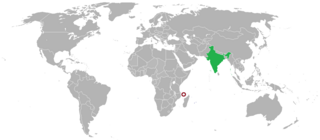
English: Map showing locations of India and Comoros on Atlas. |
| תאריך יצירה | |
| מקור |
This is a retouched picture, which means that it has been digitally altered from its original version. Modifications: Replacing India and Morocco with India and Comoros. The original can be viewed here: India_Morocco_Locator.png Modifications made by Bilingual2000 |
| יוצר | Bilingual2000 |
- Other information
This file is created to help readers locate the position of India and Comoros on world map.
רישיון
אני, בעל זכויות היוצרים על היצירה הזאת, מפרסם אותה בזאת תחת הרישיונות הבאים:

|
מוענקת בכך הרשות להעתיק, להפיץ או לשנות את המסמך הזה, לפי תנאי הרישיון לשימוש חופשי במסמכים של גנו, גרסה 1.2 או כל גרסה מאוחרת יותר שתפורסם על־ידי המוסד לתוכנה חופשית; ללא פרקים קבועים, ללא טקסט עטיפה קדמית וללא טקסט עטיפה אחורית. עותק של הרישיון כלול בפרק שכותרתו הרישיון לשימוש חופשי במסמכים של גנו. |
הקובץ הזה מתפרסם לפי תנאי רישיון קריאייטיב קומונז ייחוס-שיתוף זהה 4.0 בין־לאומי.
- הנכם רשאים:
- לשתף – להעתיק, להפיץ ולהעביר את העבודה
- לערבב בין עבודות – להתאים את העבודה
- תחת התנאים הבאים:
- ייחוס – יש לתת ייחוס הולם, לתת קישור לרישיון, ולציין אם נעשו שינויים. אפשר לעשות את זה בכל צורה סבירה, אבל לא בשום צורה שמשתמע ממנה שמעניק הרישיון תומך בך או בשימוש שלך.
- שיתוף זהה – אם תיצרו רמיקס, תשנו, או תבנו על החומר, חובה עליכם להפיץ את התרומות שלך לפי תנאי רישיון זהה או תואם למקור.
הנכם מוזמנים לבחור את הרישיון הרצוי בעיניכם.
היסטוריית הקובץ
ניתן ללחוץ על תאריך/שעה כדי לראות את הקובץ כפי שנראה באותו זמן.
| תאריך/שעה | תמונה ממוזערת | ממדים | משתמש | הערה | |
|---|---|---|---|---|---|
| נוכחית | 15:09, 10 באפריל 2017 | | 625 × 1,425 (36 ק"ב) | Bilingual2000 | Uploaded a file with wrong marking earlier. Instead of Comoros, the nation "Morocco" was marked despite the file name. Now trying to replace the wrong file with this. |
| 17:44, 9 באפריל 2017 |  | 625 × 1,425 (35 ק"ב) | Bilingual2000 | Uploading a self-made file using File Upload Wizard |
שימוש בקובץ
הדף הבא משתמש בקובץ הזה:
שימוש גלובלי בקובץ
אתרי הוויקי השונים הבאים משתמשים בקובץ זה:
- שימוש באתר en.wikipedia.org
- שימוש באתר ru.wikipedia.org
- שימוש באתר www.wikidata.org