
קובץ:Rodrigues Island location map.svg

גודל התצוגה המקדימה הזאת מסוג PNG של קובץ ה־SVG הזה: 637 × 600 פיקסלים. רזולוציות אחרות: 255 × 240 פיקסלים | 510 × 480 פיקסלים | 816 × 768 פיקסלים | 1,088 × 1,024 פיקסלים | 2,176 × 2,048 פיקסלים | 1,700 × 1,600 פיקסלים.
לקובץ המקורי (קובץ SVG, הגודל המקורי: 1,700 × 1,600 פיקסלים, גודל הקובץ: 81 ק"ב)
| זהו קובץ שמקורו במיזם ויקישיתוף. תיאורו בדף תיאור הקובץ המקורי (בעברית) מוצג למטה. |
תקציר
| תיאור |
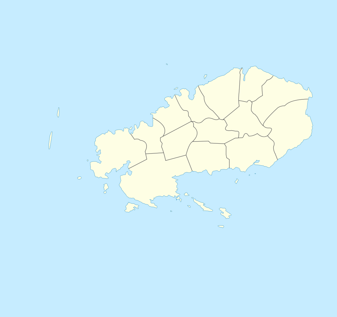
Deutsch: Zonenkarte der Insel Rodrigues English: Topographic map in French of Rodrigues Island, Mauritius Scale : 1:372,000 (accuracy : about 93 m) ; Printing size : 7.79 x 7.33 cm ; Note : The background map is a raster image embedded in the SVG file. Français : Carte de localisation de l'île de Rodrigues, Maurice ; UTM projection ; WGS84 datum ; shaded relief (composite image of N-W, W and N lightning positions) ;Échelle : 1:372 000 (précision : environ 93 m) ; Taille d'impression : 7,79 x 7,33 cm ; Note : Le fond de carte est une image bitmap embarquée dans le fichier SVG. Geographic limits of the map: *West : 63° 15' 34.66" E *East : 63° 31' 14.68" E *North : 19° 37' 09.97" S *South : 19° 51' 02.05" S |
| תאריך יצירה | (UTC) |
| מקור | |
| יוצר |
|
| זוהי תמונה מרוטשת, זאת אומרת שהתמונה שונתה בצורה דיגיטלית מהמקור. Modifications: locator map style. את התמונה המקורית ניתן לראות ב: Rodrigues Island topographic-zones map-fr.svg. השינוי בוצע על ידי Wfigpower.
|
רישיון
אני, בעל זכויות היוצרים על עבודה זו, מפרסם בזאת את העבודה תחת הרישיון הבא:
הקובץ הזה מתפרסם לפי תנאי רישיון קריאייטיב קומונז ייחוס-שיתוף זהה 3.0 לא מותאם.
- הנכם רשאים:
- לשתף – להעתיק, להפיץ ולהעביר את העבודה
- לערבב בין עבודות – להתאים את העבודה
- תחת התנאים הבאים:
- ייחוס – יש לתת ייחוס הולם, לתת קישור לרישיון, ולציין אם נעשו שינויים. אפשר לעשות את זה בכל צורה סבירה, אבל לא בשום צורה שמשתמע ממנה שמעניק הרישיון תומך בך או בשימוש שלך.
- שיתוף זהה – אם תיצרו רמיקס, תשנו, או תבנו על החומר, חובה עליכם להפיץ את התרומות שלך לפי תנאי רישיון זהה או תואם למקור.
יומן העלאה מקורי
This image is a derivative work of the following images:
- File:Rodrigues_Island_topographic-zones_map-fr.svg licensed with Cc-by-sa-3.0
- 2010-08-11T08:27:58Z M0tty 1700x1600 (993021 Bytes) {{Information |Description={{de|1=Zonenkarte der Insel Rodrigues}} {{en|Topographic map in French of [[:en:Rodrigues (island)|Rodrigues Island]], [[:en:Mauritius|Mauritius]]Scale : 1:372,000 (accuracy : about 93 m) ; Printing
Uploaded with derivativeFX
היסטוריית הקובץ
ניתן ללחוץ על תאריך/שעה כדי לראות את הקובץ כפי שנראה באותו זמן.
| תאריך/שעה | תמונה ממוזערת | ממדים | משתמש | הערה | |
|---|---|---|---|---|---|
| נוכחית | 18:06, 27 בדצמבר 2011 | | 1,600 × 1,700 (81 ק"ב) | Xfigpower | == {{int:filedesc}} == {{Information |Description={{de|1=Zonenkarte der Insel Rodrigues}} {{en|Topographic map in French of Rodrigues Island, Mauritius<br/>Scale : 1:372,000 (accuracy : about 93 m) ; Printing s |
שימוש בקובץ
הדף הבא משתמש בקובץ הזה:
שימוש גלובלי בקובץ
אתרי הוויקי השונים הבאים משתמשים בקובץ זה:
- שימוש באתר eo.wikipedia.org
- שימוש באתר fr.wikipedia.org