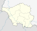
קובץ:Saarland location map 2.svg

גודל התצוגה המקדימה הזאת מסוג PNG של קובץ ה־SVG הזה: 721 × 600 פיקסלים. רזולוציות אחרות: 289 × 240 פיקסלים | 577 × 480 פיקסלים | 923 × 768 פיקסלים | 1,231 × 1,024 פיקסלים | 2,461 × 2,048 פיקסלים | 1,060 × 882 פיקסלים.
לקובץ המקורי (קובץ SVG, הגודל המקורי: 1,060 × 882 פיקסלים, גודל הקובץ: 244 ק"ב)
היסטוריית הקובץ
ניתן ללחוץ על תאריך/שעה כדי לראות את הקובץ כפי שנראה באותו זמן.
| תאריך/שעה | תמונה ממוזערת | ממדים | משתמש | הערה | |
|---|---|---|---|---|---|
| נוכחית | 23:15, 14 במאי 2013 |  | 882 × 1,060 (244 ק"ב) | NordNordWest | == {{int:filedesc}} == {{Information |Description= {{de|Positionskarte für das Saarland, Deutschland}} Geographische Begrenzung der Karte: * N: 49.7° N * S: 49.05° N * W: 6.3° O * O: 7.5° O {{en|Location map of... |
שימוש בקובץ
הדפים הבאים משתמשים בקובץ הזה:
שימוש גלובלי בקובץ
אתרי הוויקי השונים הבאים משתמשים בקובץ זה:
- שימוש באתר bg.wikipedia.org
- שימוש באתר de.wikipedia.org
- Auersmacher
- Knorscheid
- Theley
- Altforweiler
- Bisten
- Berus
- Felsberg (Saar)
- Altbreitenfelderhof
- Wohnstadt (Überherrn)
- Düren (Saar)
- Liste von Sehenswürdigkeiten im Saarland
- Niedaltdorf
- Oberlimberg
- Saarschleife
- Neuforweiler
- Differten
- Bedersdorf
- Ihn (Wallerfangen)
- St. Barbara (Wallerfangen)
- Ittersdorf
- Kerlingen
- Rammelfangen
- Silwingen
- Schwarzenholz
- Nennig
- Reisbach (Saarwellingen)
- Hostenbach
- Werbeln
- Bergweiler (Saarland)
- Rohrbach (St. Ingbert)
- Gresaubach
- Besch
- Wochern
- Büschdorf (Perl)
- Keßlingen
- Köllerbach
- Schwarzenacker
- Sötern
- Kirrberg (Homburg)
- Waldstadion Homburg
- Ludwigsparkstadion
- Ellenfeldstadion
- Völklinger Hütte
- Alschbach
- Flughafen Saarbrücken
- Siersburg
- Einöd (Homburg)
- Hasborn-Dautweiler
- Wörschweiler


