
קובץ:Scandinavia1219.png
גודל התצוגה המקדימה הזאת: 513 × 600 פיקסלים. רזולוציות אחרות: 205 × 240 פיקסלים | 410 × 480 פיקסלים | 657 × 768 פיקסלים | 876 × 1,024 פיקסלים | 1,500 × 1,754 פיקסלים.
לקובץ המקורי (1,500 × 1,754 פיקסלים, גודל הקובץ: 41 ק"ב, סוג MIME: image/png)
| זהו קובץ שמקורו במיזם ויקישיתוף. תיאורו בדף תיאור הקובץ המקורי (בעברית) מוצג למטה. |
| תיאור |
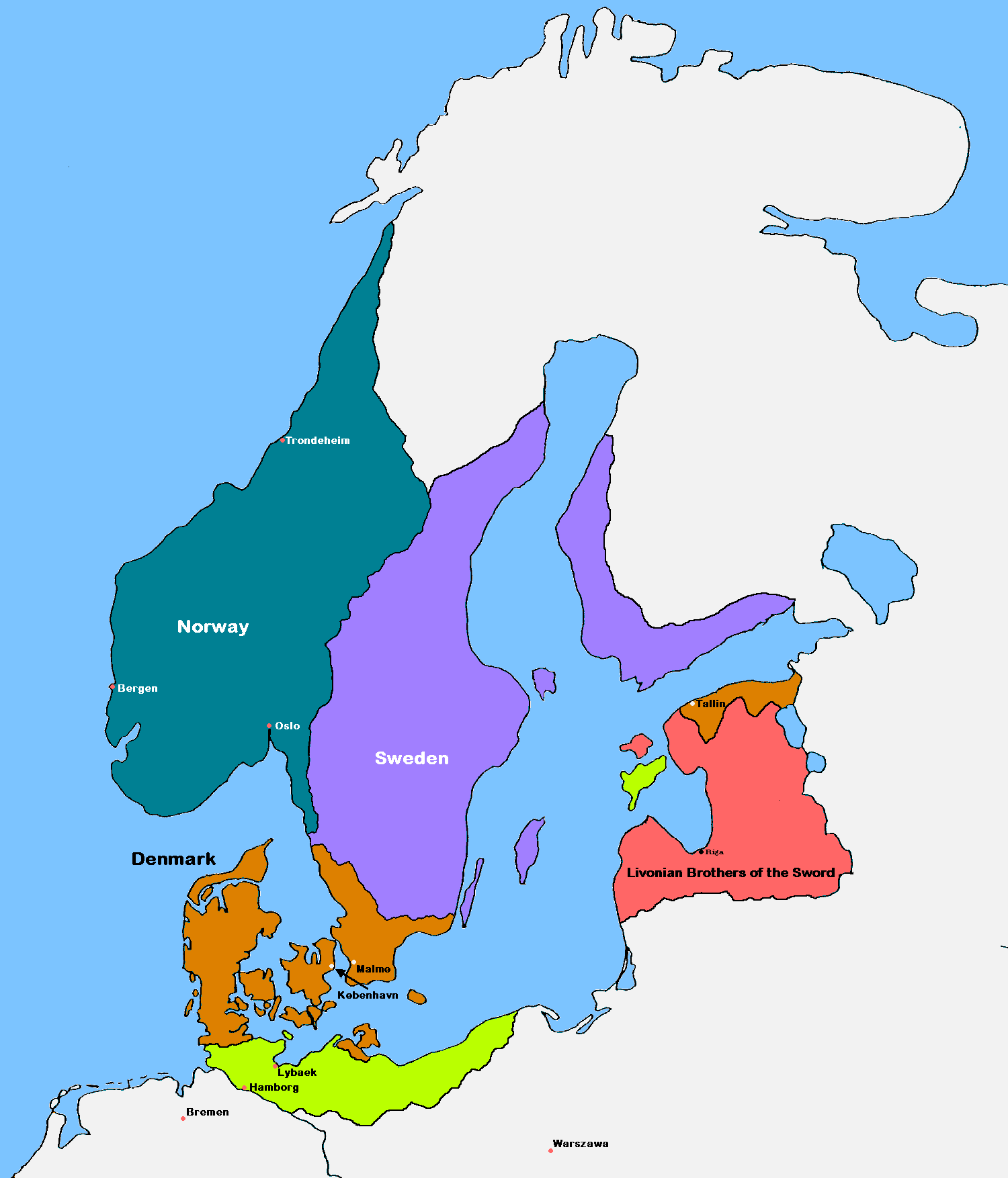
English: Update of the historical and political map, created in 2005 by Kasper Holl. It is a compressed format, has an easier colour scheme and has greater sized labels. NB on accuracy: Sweden did not reach this size until after the 1330s, when colonialization of Västerbotten started. Swedish colonialization of Finnish coast started before 1250. Sweden lost Gotland to Denmark in 1361. Trondheim has a wrong placement on map.
Denmark
Norway
Sweden
The Sword Brethren
Territories conquered by Denmark in 1219 |
| תאריך יצירה | (UTC) |
| מקור |
|
| יוצר | MasterOfHisOwnDomain |
| גרסאות אחרות |
|

אני, בעל זכויות היוצרים על היצירה הזאת, מפרסם אותה בזאת תחת הרישיונות הבאים:

|
מוענקת בכך הרשות להעתיק, להפיץ או לשנות את המסמך הזה, לפי תנאי הרישיון לשימוש חופשי במסמכים של גנו, גרסה 1.2 או כל גרסה מאוחרת יותר שתפורסם על־ידי המוסד לתוכנה חופשית; ללא פרקים קבועים, ללא טקסט עטיפה קדמית וללא טקסט עטיפה אחורית. עותק של הרישיון כלול בפרק שכותרתו הרישיון לשימוש חופשי במסמכים של גנו. |
| הקובץ הזה מתפרסם לפי תנאי רישיון קריאייטיב קומונז ייחוס-שיתוף זהה 3.0 לא מותאם. | ||
| ||
| תבנית רישוי זו הוספה לקובץ כחלק מעדכון רישיון GFDL. |
הנכם מוזמנים לבחור את הרישיון הרצוי בעיניכם.
היסטוריית הקובץ
ניתן ללחוץ על תאריך/שעה כדי לראות את הקובץ כפי שנראה באותו זמן.
| תאריך/שעה | תמונה ממוזערת | ממדים | משתמש | הערה | |
|---|---|---|---|---|---|
| נוכחית | 20:18, 16 בספטמבר 2016 | | 1,754 × 1,500 (41 ק"ב) | VulpesVulpes42 | According to the description, the cities of Stockholm and Göteborg did not exist in 1219, so I removed them from the map. |
| 17:37, 12 באוגוסט 2009 |  | 1,754 × 1,500 (68 ק"ב) | MasterOfHisOwnDomain | Update of the historical and political map, created in 2005 by Kasper Holl. It is a compressed format, has an easier colour scheme and has greater sized labels. {{Self|GFDL|Cc-by-sa-3.0-migrated}} Category:Maps of the history of Denmark [[Category: |
שימוש בקובץ
![]() אין בוויקיפדיה דפים המשתמשים בקובץ זה.
אין בוויקיפדיה דפים המשתמשים בקובץ זה.
שימוש גלובלי בקובץ
אתרי הוויקי השונים הבאים משתמשים בקובץ זה:
- שימוש באתר ast.wikipedia.org
- שימוש באתר be.wikipedia.org
- שימוש באתר ca.wikipedia.org
- שימוש באתר cs.wikipedia.org
- שימוש באתר da.wikipedia.org
- שימוש באתר de.wikipedia.org
- שימוש באתר dsb.wikipedia.org
- שימוש באתר el.wikipedia.org
- שימוש באתר en.wikipedia.org
- Northern Crusades
- History of Denmark
- Valdemar II of Denmark
- Duchy of Pomerania
- Otto I, Duke of Brunswick-Lüneburg
- Battle of Bornhöved (1227)
- Christianization of Pomerania
- Dominium maris baltici
- Template:Scandinavia map, 1219
- Denmark–Sweden border
- Borders of Denmark
- User:Falcaorib/Baltic States
- User:Falcaorib/Sweden and Finland
- שימוש באתר eo.wikipedia.org
- שימוש באתר es.wikipedia.org
- שימוש באתר et.wikipedia.org
- שימוש באתר fr.wikipedia.org
- שימוש באתר fy.wikipedia.org