
קובץ:Strait tiran 83.jpg
גודל התצוגה המקדימה הזאת: 472 × 599 פיקסלים. רזולוציות אחרות: 189 × 240 פיקסלים | 378 × 480 פיקסלים | 996 × 1,264 פיקסלים.
לקובץ המקורי (996 × 1,264 פיקסלים, גודל הקובץ: 198 ק"ב, סוג MIME: image/jpeg)
| זהו קובץ שמקורו במיזם ויקישיתוף. תיאורו בדף תיאור הקובץ המקורי (בעברית) מוצג למטה. |
| תיאור |
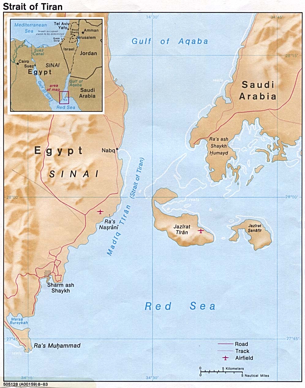
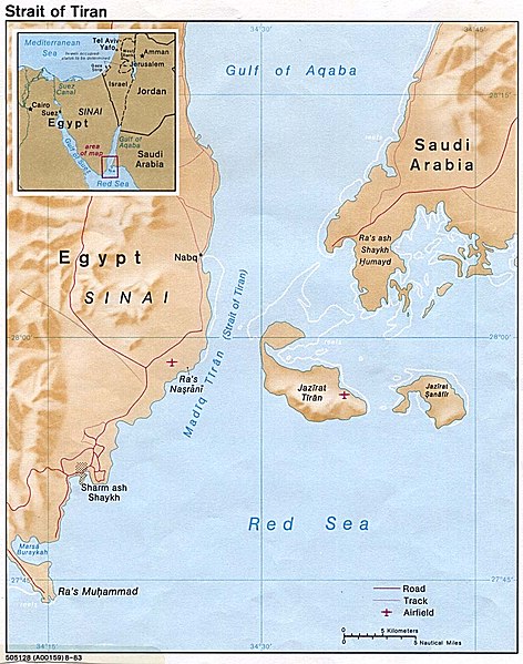
English: Strait of Tiran between Gulf of Aqaba and Red Sea |
|||
| תאריך יצירה | ||||
| מקור | http://www.lib.utexas.edu/maps/middle_east_and_asia/strait_tiran_83.jpg | |||
| יוצר | "The following maps were produced by the U.S. Central Intelligence Agency, unless otherwise indicated." | |||
| אישורים והיתרים (שימוש חוזר בקובץ זה) |
|
|||
| גרסאות אחרות | العربيَّة |

היסטוריית הקובץ
ניתן ללחוץ על תאריך/שעה כדי לראות את הקובץ כפי שנראה באותו זמן.
| תאריך/שעה | תמונה ממוזערת | ממדים | משתמש | הערה | |
|---|---|---|---|---|---|
| נוכחית | 19:46, 23 בפברואר 2007 | | 1,264 × 996 (198 ק"ב) | Monack | {{Information |Description = {{en|Strait of Tiran between Gulf of Aqaba and Red Sea}} |Source = http://www.lib.utexas.edu/maps/middle_east_and_asia/strait_tiran_83.jpg |Date = 1983 |Author = "The following maps were produced by the U.S. Central Intellige |
שימוש בקובץ
הדף הבא משתמש בקובץ הזה:
שימוש גלובלי בקובץ
אתרי הוויקי השונים הבאים משתמשים בקובץ זה:
- שימוש באתר af.wikipedia.org
- שימוש באתר als.wikipedia.org
- שימוש באתר ar.wikipedia.org
- שימוש באתר arz.wikipedia.org
- שימוש באתר az.wikipedia.org
- שימוש באתר be.wikipedia.org
- שימוש באתר bg.wikipedia.org
- שימוש באתר bn.wikipedia.org
- שימוש באתר ca.wikipedia.org
- שימוש באתר cs.wikipedia.org
- שימוש באתר da.wikipedia.org
- שימוש באתר de.wikipedia.org
- שימוש באתר el.wikipedia.org
- שימוש באתר en.wikipedia.org
- שימוש באתר en.wikivoyage.org
- שימוש באתר es.wikipedia.org
- שימוש באתר eu.wikipedia.org
- שימוש באתר fa.wikipedia.org
- שימוש באתר fi.wikipedia.org
- שימוש באתר fr.wikipedia.org
- שימוש באתר hy.wikipedia.org
- שימוש באתר id.wikipedia.org
- שימוש באתר it.wikipedia.org