
קובץ:U.S. Counties.png
גודל התצוגה המקדימה הזאת: 800 × 591 פיקסלים. רזולוציות אחרות: 320 × 237 פיקסלים | 640 × 473 פיקסלים | 1,024 × 757 פיקסלים | 1,280 × 946 פיקסלים | 2,560 × 1,893 פיקסלים | 4,200 × 3,105 פיקסלים.
לקובץ המקורי (4,200 × 3,105 פיקסלים, גודל הקובץ: 1.55 מ"ב, סוג MIME: image/png)
| זהו קובץ שמקורו במיזם ויקישיתוף. תיאורו בדף תיאור הקובץ המקורי (בעברית) מוצג למטה. |
תקציר
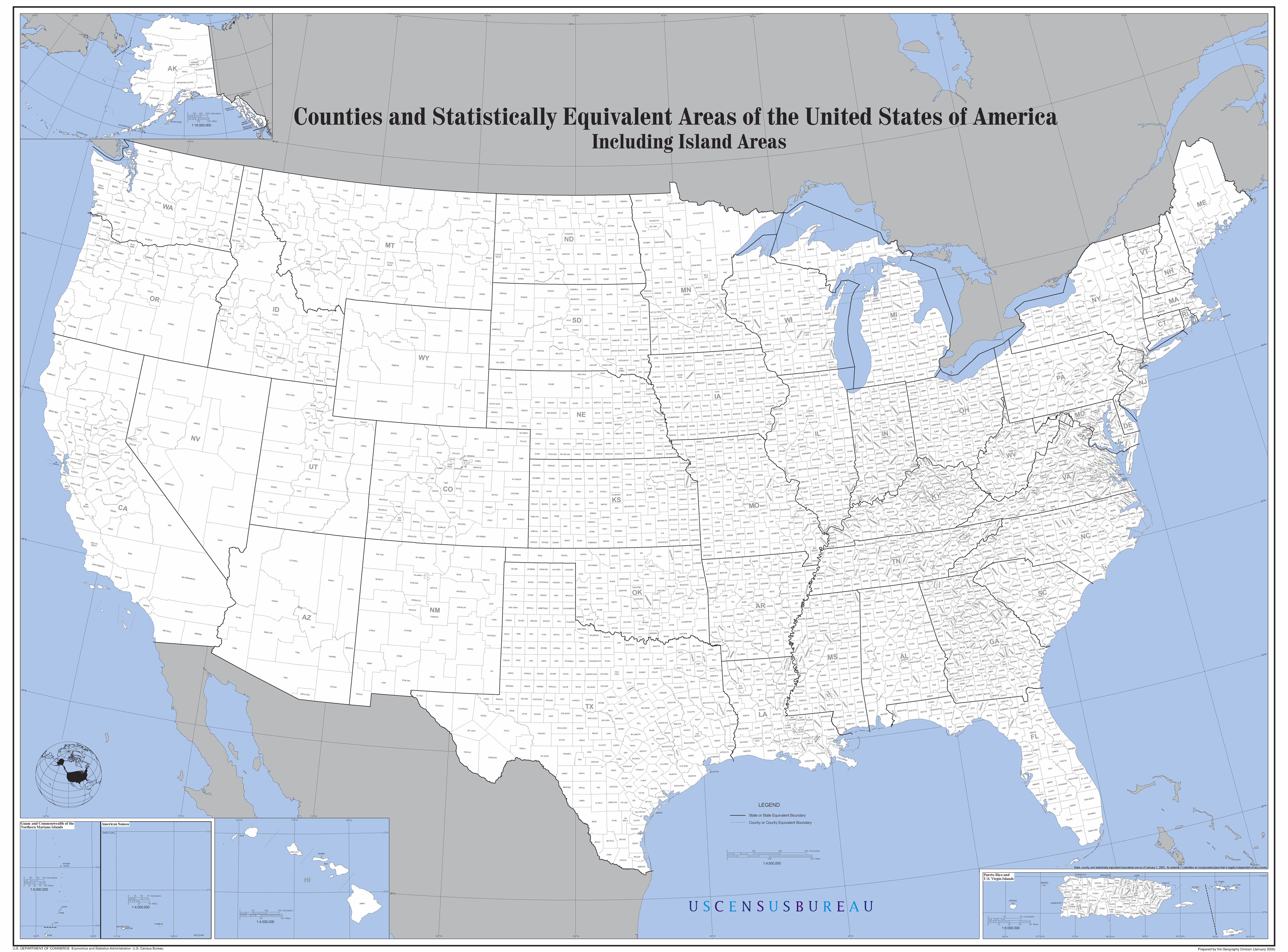
Map of the United States showing all counties.
Work of the U.S. Census Bureau. From the Census website.
רישיון
This work is in the public domain in the United States because it is a work prepared by an officer or employee of the United States Government as part of that person’s official duties under the terms of Title 17, Chapter 1, Section 105 of the US Code.
Note: This only applies to original works of the Federal Government and not to the work of any individual U.S. state, territory, commonwealth, county, municipality, or any other subdivision. This template also does not apply to postage stamp designs published by the United States Postal Service since 1978. (See § 313.6(C)(1) of Compendium of U.S. Copyright Office Practices). It also does not apply to certain US coins; see The US Mint Terms of Use.
|
 | |
| הקובץ הזה זוהה כקובץ חופשי מכל מגבלה ידועה תחת חוק זכויות היוצרים, כולל כל הזכויות הקשורות והסמוכות. | ||
היסטוריית הקובץ
ניתן ללחוץ על תאריך/שעה כדי לראות את הקובץ כפי שנראה באותו זמן.
| תאריך/שעה | תמונה ממוזערת | ממדים | משתמש | הערה | |
|---|---|---|---|---|---|
| נוכחית | 23:04, 16 ביולי 2015 | | 3,105 × 4,200 (1.55 מ"ב) | Cmdrjameson | Compressed with pngout. Reduced by 632kB (28% decrease). |
| 15:26, 30 ביוני 2007 |  | 3,105 × 4,200 (2.17 מ"ב) | AldeBaer | Map of the United States showing all counties. |
שימוש בקובץ
![]() אין בוויקיפדיה דפים המשתמשים בקובץ זה.
אין בוויקיפדיה דפים המשתמשים בקובץ זה.