
קובץ:Rosewood Massacre Map.PNG
גודל התצוגה המקדימה הזאת: 659 × 599 פיקסלים. רזולוציות אחרות: 264 × 240 פיקסלים | 528 × 480 פיקסלים | 742 × 675 פיקסלים.
לקובץ המקורי (742 × 675 פיקסלים, גודל הקובץ: 46 ק"ב, סוג MIME: image/png)
| זהו קובץ שמקורו במיזם ויקישיתוף. תיאורו בדף תיאור הקובץ המקורי (בעברית) מוצג למטה. |
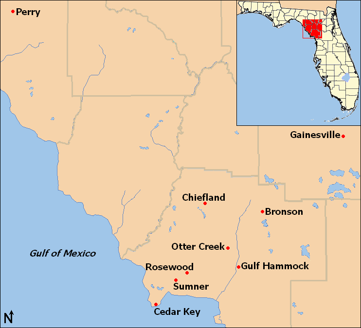
| תיאור | Map of locations mentioned in the Rosewood massacre article in northwestern Florida, United States. |
| תאריך יצירה | |
| מקור | taken from US Census website [1] and modified by User:Ruhrfisch. Inset map is modified version of File:Map of Florida highlighting Gilchrist County.svg |
| יוצר | US Census, Ruhrfisch, inset is based on map by User:Dbenbenn |
| אישורים והיתרים (שימוש חוזר בקובץ זה) |
US Census / US Government work is public domain, my modifications licensed under the GNU Free Documentation License |

|
מוענקת בכך הרשות להעתיק, להפיץ או לשנות את המסמך הזה, לפי תנאי הרישיון לשימוש חופשי במסמכים של גנו, גרסה 1.2 או כל גרסה מאוחרת יותר שתפורסם על־ידי המוסד לתוכנה חופשית; ללא פרקים קבועים, ללא טקסט עטיפה קדמית וללא טקסט עטיפה אחורית. עותק של הרישיון כלול בפרק שכותרתו הרישיון לשימוש חופשי במסמכים של גנו. |
| הקובץ הזה מתפרסם לפי תנאי רישיון קריאייטיב קומונז ייחוס-שיתוף זהה 3.0 לא מותאם. | ||
| ||
| תבנית רישוי זו הוספה לקובץ כחלק מעדכון רישיון GFDL. |
היסטוריית הקובץ
ניתן ללחוץ על תאריך/שעה כדי לראות את הקובץ כפי שנראה באותו זמן.
| תאריך/שעה | תמונה ממוזערת | ממדים | משתמש | הערה | |
|---|---|---|---|---|---|
| נוכחית | 17:12, 14 באפריל 2009 | | 675 × 742 (46 ק"ב) | Ruhrfisch | Add inset locator map of Florida, based on File:Map of Florida highlighting Gilchrist County.svg, all other information is the same |
| 08:59, 14 באפריל 2009 |  | 675 × 742 (30 ק"ב) | Ruhrfisch | {{Information| |Description= Map of locations mentioned in the Rosewood massacre article in northwestern Florida, United States. |Source= taken from US Census website [http://factfinder.census.gov/] and modified by [[User:Ruhrfisc |
שימוש בקובץ
הדף הבא משתמש בקובץ הזה:
שימוש גלובלי בקובץ
אתרי הוויקי השונים הבאים משתמשים בקובץ זה:
- שימוש באתר ar.wikipedia.org
- שימוש באתר ca.wikipedia.org
- שימוש באתר en.wikipedia.org
- שימוש באתר es.wikipedia.org
- שימוש באתר eu.wikipedia.org
- שימוש באתר fr.wikipedia.org
- שימוש באתר ko.wikipedia.org
- שימוש באתר pt.wikipedia.org
- שימוש באתר www.wikidata.org