
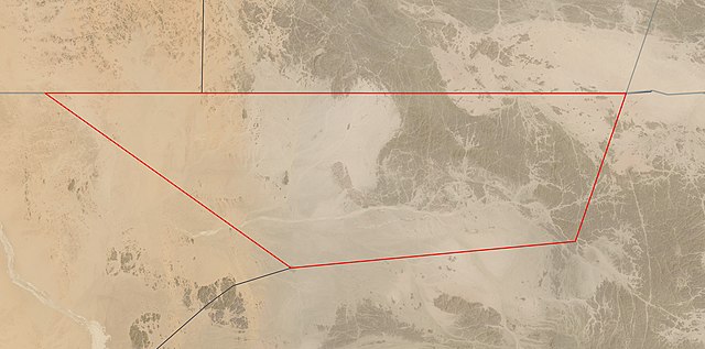
קובץ:Satellite image of Bir Tawil.jpg

גודל התצוגה המקדימה הזאת: 800 × 396 פיקסלים. רזולוציות אחרות: 320 × 158 פיקסלים | 640 × 317 פיקסלים | 1,024 × 507 פיקסלים | 1,280 × 634 פיקסלים | 4,031 × 1,996 פיקסלים.
לקובץ המקורי (4,031 × 1,996 פיקסלים, גודל הקובץ: 1.23 מ"ב, סוג MIME: image/jpeg)
| זהו קובץ שמקורו במיזם ויקישיתוף. תיאורו בדף תיאור הקובץ המקורי (בעברית) מוצג למטה. |
תקציר
רישיון
| קובץ זה נמצא ברשות הציבור מכיוון שהוא נוצר על ידי נאס"א. מדיניות זכויות היוצרים של נאס"א קובעת ש"חומרים של NASA אינם מוגנים בזכויות יוצרים אלא אם צוין אחרת". (דף מדיניות זכויות היוצרים ב-NASA או מדיניות שימוש בתמונות ב-JPL). | ||
 |
אזהרות:
|
היסטוריית הקובץ
ניתן ללחוץ על תאריך/שעה כדי לראות את הקובץ כפי שנראה באותו זמן.
| תאריך/שעה | תמונה ממוזערת | ממדים | משתמש | הערה | |
|---|---|---|---|---|---|
| נוכחית | 06:02, 19 במאי 2021 | | 1,996 × 4,031 (1.23 מ"ב) | Themium | New border map from https://worldview.earthdata.nasa.gov/ (2nd try) |
| 22:56, 18 במאי 2021 |  | 1,996 × 4,031 (1.23 מ"ב) | Themium | New border map from https://worldview.earthdata.nasa.gov/ | |
| 02:17, 13 באפריל 2021 |  | 2,008 × 4,167 (1.26 מ"ב) | Themium | Uploaded a work by Landsat 8 / OLI from https://worldview.earthdata.nasa.gov/?v=32.55626092826267,21.355252631649694,34.600300491074385,22.35704493821523&l=Reference_Labels(hidden),Reference_Features(hidden),Coastlines(hidden),HLS_L30_Nadir_BRDF_Adjusted_Reflectance,MODIS_Combined_L3_Nadir-BRDF_Daily(hidden),VIIRS_NOAA20_CorrectedReflectance_TrueColor(hidden),VIIRS_SNPP_CorrectedReflectance_TrueColor(hidden),MODIS_Aqua_CorrectedReflectance_TrueColor(hidden),MODIS_Terra_CorrectedReflectance_Tr... |
שימוש בקובץ
הדף הבא משתמש בקובץ הזה:
שימוש גלובלי בקובץ
אתרי הוויקי השונים הבאים משתמשים בקובץ זה:
- שימוש באתר ar.wikipedia.org
- שימוש באתר arz.wikipedia.org
- שימוש באתר ast.wikipedia.org
- שימוש באתר be.wikipedia.org
- שימוש באתר ca.wikipedia.org
- שימוש באתר de.wikivoyage.org
- שימוש באתר en.wikipedia.org
- שימוש באתר en.wikivoyage.org
- שימוש באתר eo.wikipedia.org
- שימוש באתר es.wikipedia.org
- שימוש באתר gl.wikipedia.org
- שימוש באתר ja.wikipedia.org
- שימוש באתר pt.wikipedia.org
- שימוש באתר ro.wikipedia.org
- שימוש באתר tr.wikipedia.org
- שימוש באתר www.wikidata.org