
קובץ:LocationUganda.svg

גודל התצוגה המקדימה הזאת מסוג PNG של קובץ ה־SVG הזה: 800 × 400 פיקסלים. רזולוציות אחרות: 320 × 160 פיקסלים | 640 × 320 פיקסלים | 1,024 × 512 פיקסלים | 1,280 × 640 פיקסלים | 2,560 × 1,280 פיקסלים | 1,000 × 500 פיקסלים.
לקובץ המקורי (קובץ SVG, הגודל המקורי: 1,000 × 500 פיקסלים, גודל הקובץ: 2.76 מ"ב)
| זהו קובץ שמקורו במיזם ויקישיתוף. תיאורו בדף תיאור הקובץ המקורי (בעברית) מוצג למטה. |
תקציר
| תיאור |
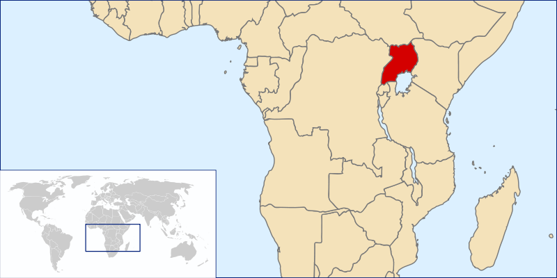
English: Uganda Location
עברית: מיקום אוגנדה |
| תאריך יצירה | |
| מקור | Original by User:Vardion, Image:A large blank world map with oceans marked in blue.svg |
| יוצר |
|
| אישורים והיתרים (שימוש חוזר בקובץ זה) |
Own work, copyleft: Multi-license with GFDL and Creative Commons CC-BY-SA-2.5 and older versions (2.0 and 1.0) |
רישיון
אני, בעל זכויות היוצרים על היצירה הזאת, מפרסם אותה בזאת תחת הרישיונות הבאים:

|
מוענקת בכך הרשות להעתיק, להפיץ או לשנות את המסמך הזה, לפי תנאי הרישיון לשימוש חופשי במסמכים של גנו, גרסה 1.2 או כל גרסה מאוחרת יותר שתפורסם על־ידי המוסד לתוכנה חופשית; ללא פרקים קבועים, ללא טקסט עטיפה קדמית וללא טקסט עטיפה אחורית. עותק של הרישיון כלול בפרק שכותרתו הרישיון לשימוש חופשי במסמכים של גנו. |
| הקובץ הזה מתפרסם לפי תנאי רישיון קריאייטיב קומונז ייחוס-שיתוף זהה 3.0 לא מותאם. | ||
| ||
| תבנית רישוי זו הוספה לקובץ כחלק מעדכון רישיון GFDL. |
- הנכם רשאים:
- לשתף – להעתיק, להפיץ ולהעביר את העבודה
- לערבב בין עבודות – להתאים את העבודה
- תחת התנאים הבאים:
- ייחוס – יש לתת ייחוס הולם, לתת קישור לרישיון, ולציין אם נעשו שינויים. אפשר לעשות את זה בכל צורה סבירה, אבל לא בשום צורה שמשתמע ממנה שמעניק הרישיון תומך בך או בשימוש שלך.
- שיתוף זהה – אם תיצרו רמיקס, תשנו, או תבנו על החומר, חובה עליכם להפיץ את התרומות שלך לפי תנאי רישיון זהה או תואם למקור.
הנכם מוזמנים לבחור את הרישיון הרצוי בעיניכם.
היסטוריית הקובץ
ניתן ללחוץ על תאריך/שעה כדי לראות את הקובץ כפי שנראה באותו זמן.
| תאריך/שעה | תמונה ממוזערת | ממדים | משתמש | הערה | |
|---|---|---|---|---|---|
| נוכחית | 05:22, 10 בדצמבר 2006 | | 500 × 1,000 (2.76 מ"ב) | Rei-artur | {{Information |Description=* ''(en)'' World Map * ''(pt)'' Mapa Mundo * ''(de)'' Weltkarte * ''(sv)'' Världskarta |Source=Original by User:Vardion, Image:A large blank world map with oceans marked in blue.svg |Date=~~~~~ |Author={{User:Rei-artur |
שימוש בקובץ
הדפים הבאים משתמשים בקובץ הזה:
שימוש גלובלי בקובץ
אתרי הוויקי השונים הבאים משתמשים בקובץ זה:
- שימוש באתר als.wikipedia.org
- שימוש באתר am.wikipedia.org
- שימוש באתר an.wikipedia.org
- שימוש באתר ar.wikipedia.org
- שימוש באתר arz.wikipedia.org
- שימוש באתר ast.wikipedia.org
- שימוש באתר ban.wikipedia.org
- שימוש באתר bcl.wikipedia.org
- שימוש באתר be.wikipedia.org
- שימוש באתר bjn.wikipedia.org
- שימוש באתר bm.wikipedia.org
- שימוש באתר bn.wikipedia.org
- שימוש באתר bo.wikipedia.org
- שימוש באתר br.wikipedia.org
- שימוש באתר ca.wikipedia.org
- שימוש באתר ckb.wikipedia.org
- שימוש באתר cs.wikipedia.org
- שימוש באתר de.wikipedia.org
- שימוש באתר de.wikinews.org
- שימוש באתר dsb.wikipedia.org
- שימוש באתר dv.wikipedia.org
- שימוש באתר en.wikipedia.org
- Geography of Uganda
- History of Uganda (1963–1971)
- Second Republic of Uganda
- History of Uganda (1979–1986)
- User:Chris huh/List of African countries
- United Nations Security Council Resolution 177
- Portal:Africa/Countries/Selected country
- Portal:Africa/Countries/Selected country/51
- Outline of Uganda
- Uganda (1962–1963)
- שימוש באתר en.wikivoyage.org
- שימוש באתר eo.wikipedia.org
- שימוש באתר eo.wiktionary.org
- שימוש באתר es.wikipedia.org