
קובץ:Ptolemy, Soria et Terra Santa nuova tavola (FL199985836 2368942).jpg

גודל התצוגה המקדימה הזאת: 800 × 532 פיקסלים. רזולוציות אחרות: 320 × 213 פיקסלים | 640 × 426 פיקסלים | 1,024 × 682 פיקסלים | 1,280 × 852 פיקסלים | 2,560 × 1,704 פיקסלים | 5,048 × 3,360 פיקסלים.
לקובץ המקורי (5,048 × 3,360 פיקסלים, גודל הקובץ: 6.43 מ"ב, סוג MIME: image/jpeg)
| זהו קובץ שמקורו במיזם ויקישיתוף. תיאורו בדף תיאור הקובץ המקורי (בעברית) מוצג למטה. |
תקציר
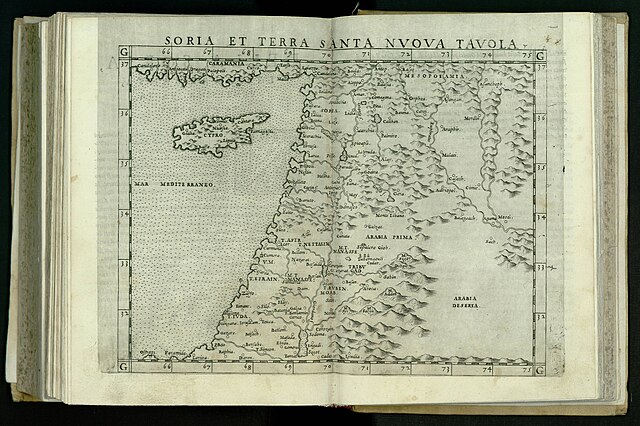
| תלמי: Soria et Terra Santa nuova tavola
( |
||||||||||||||||||||||||
|---|---|---|---|---|---|---|---|---|---|---|---|---|---|---|---|---|---|---|---|---|---|---|---|---|
| אומן |
| |||||||||||||||||||||||
| יוצרים נוספים | Ziletti, Giordano, active 16th century Gastaldi, Giacomo, approximately 1500-approximately 1565 | |||||||||||||||||||||||
| כותרת |
Soria et Terra Santa nuova tavola |
|||||||||||||||||||||||
| מפרסם |
Giordano Ziletti |
|||||||||||||||||||||||
| תיאור |
Soria et Terra Santa nuova tavola. |
|||||||||||||||||||||||
| שפה | לטינית | |||||||||||||||||||||||
| תאריך הוצאה לאור | 1564 | |||||||||||||||||||||||
| ממדים | 182 × 240 מ"מ | |||||||||||||||||||||||
| אוסף |
|
|||||||||||||||||||||||
| מיקום נוכחי |
|
|||||||||||||||||||||||
| מיקום הוצאה | ונציה | |||||||||||||||||||||||
| חיפוש בקטלוג מרחב | ונציה | |||||||||||||||||||||||
| הערות | Copperplate; From: Ptolemaeus, Claudius, Geographia, Venezia, Giordano Ziletti, 1564. Map no. XXIIII Signum Aa, R 89 C 4.; Printed from the same block as the 1561 edition | |||||||||||||||||||||||
| IE PID | IE199985834 | |||||||||||||||||||||||
| רוזטה שם קובץ | FL199985836 | |||||||||||||||||||||||
| מזהה רשומה בספרייה הלאומית (P3959) | 990023689420205171 | |||||||||||||||||||||||
| חיפוש בקטלוג מרחב | לטינית, תלמי | |||||||||||||||||||||||
| חיפוש בקטלוג מרחב | Twelve tribes of IsraelMapsGiordano Ziletti | |||||||||||||||||||||||
| מקור/צלם |
|
|||||||||||||||||||||||
| גרסאות אחרות | ||||||||||||||||||||||||
| Jpg / Tif version |
|
|||||||||||||||||||||||


.jpg)

.jpg)
.jpg?uselang=he)
רישיון
The copyright situation of this work is theoretically uncertain, because in the country of origin copyright lasts 70 years after the death of the author, and the date of the author's death is unknown. However, the date of creation of the work was over 120 years ago, and it is thus a reasonable assumption that the copyright has expired (see here for the community discussion). Do not use this template if the date of death of the author is known.
| |
| הקובץ הזה זוהה כקובץ חופשי מכל מגבלה ידועה תחת חוק זכויות היוצרים, כולל כל הזכויות הקשורות והסמוכות. | |
היסטוריית הקובץ
ניתן ללחוץ על תאריך/שעה כדי לראות את הקובץ כפי שנראה באותו זמן.
| תאריך/שעה | תמונה ממוזערת | ממדים | משתמש | הערה | |
|---|---|---|---|---|---|
| נוכחית | 01:00, 29 ביולי 2023 | | 3,360 × 5,048 (6.43 מ"ב) | Geagea | pattypan 22.03 |
שימוש בקובץ
![]() אין בוויקיפדיה דפים המשתמשים בקובץ זה.
אין בוויקיפדיה דפים המשתמשים בקובץ זה.
.jpg)