
קובץ:Rigobert Bonne, Carte de l'empire de la Chine, de la Tartarie (FL46961854 2467987).jpg

גודל התצוגה המקדימה הזאת: 423 × 599 פיקסלים. רזולוציות אחרות: 169 × 240 פיקסלים | 339 × 480 פיקסלים | 542 × 768 פיקסלים | 722 × 1,024 פיקסלים | 1,445 × 2,048 פיקסלים | 5,855 × 8,297 פיקסלים.
לקובץ המקורי (5,855 × 8,297 פיקסלים, גודל הקובץ: 68.41 מ"ב, סוג MIME: image/jpeg)
| זהו קובץ שמקורו במיזם ויקישיתוף. תיאורו בדף תיאור הקובץ המקורי (בעברית) מוצג למטה. |
תקציר
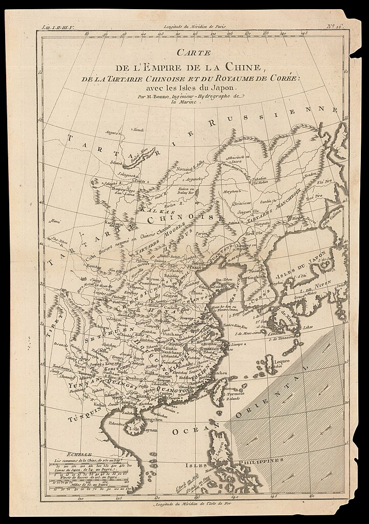
| Rigobert Bonne: Carte de l'empire de la Chine, de la Tartarie
( |
||||||||||||||||||||||||
|---|---|---|---|---|---|---|---|---|---|---|---|---|---|---|---|---|---|---|---|---|---|---|---|---|
| אומן |
|
|||||||||||||||||||||||
| כותרת |
Carte de l'empire de la Chine, de la Tartarie |
|||||||||||||||||||||||
| מפרסם |
J. L. Pellet? |
|||||||||||||||||||||||
| תיאור |
Carte de l'empire de la Chine, de la Tartarie.... Par M.Bonne. |
|||||||||||||||||||||||
| שפה | צרפתית | |||||||||||||||||||||||
| תאריך הוצאה לאור | שנות ה-1780 ייתכן | |||||||||||||||||||||||
| טכניקה | 1 map ; | |||||||||||||||||||||||
| ממדים | גובה: 315 מ"מ; רוחב: 208 מ"מ | |||||||||||||||||||||||
| אוסף |
|
|||||||||||||||||||||||
| מיקום נוכחי |
|
|||||||||||||||||||||||
| מיקום הוצאה | ז'נבה | |||||||||||||||||||||||
| הערות | Probably from: Atlas de toutes les parties connues du globe terrestre, dressé pour l'histoire philosophique et politique... no. 16. | |||||||||||||||||||||||
| IE PID | IE46961852 | |||||||||||||||||||||||
| רוזטה שם קובץ | FL46961854 | |||||||||||||||||||||||
| מזהה רשומה בספרייה הלאומית (P3959) | 990024679870205171 | |||||||||||||||||||||||
| חיפוש בקטלוג מרחב | צרפתית, Rigobert Bonne, ז'נבה | |||||||||||||||||||||||
| חיפוש בקטלוג מרחב | J. L. Pellet? | |||||||||||||||||||||||
| מקור/צלם |
|
|||||||||||||||||||||||
| גרסאות אחרות | ||||||||||||||||||||||||
| Jpg / Tif version |
|
|||||||||||||||||||||||

.jpg)

.jpg)
.jpg?uselang=he)
רישיון
The copyright situation of this work is theoretically uncertain, because in the country of origin copyright lasts 70 years after the death of the author, and the date of the author's death is unknown. However, the date of creation of the work was over 120 years ago, and it is thus a reasonable assumption that the copyright has expired (see here for the community discussion). Do not use this template if the date of death of the author is known.
| |
| הקובץ הזה זוהה כקובץ חופשי מכל מגבלה ידועה תחת חוק זכויות היוצרים, כולל כל הזכויות הקשורות והסמוכות. | |
היסטוריית הקובץ
ניתן ללחוץ על תאריך/שעה כדי לראות את הקובץ כפי שנראה באותו זמן.
| תאריך/שעה | תמונה ממוזערת | ממדים | משתמש | הערה | |
|---|---|---|---|---|---|
| נוכחית | 01:22, 1 באוגוסט 2023 | | 8,297 × 5,855 (68.41 מ"ב) | Geagea | c:User:Rillke/bigChunkedUpload.js: =={{int:filedesc}}== {{Artwork |artist = {{Creator|wikidata=Q721492}} |author = |title = Carte de l'empire de la Chine, de la Tartarie |description = Carte de l'empire de la Chine, de la Tartarie.... Par M.Bonne. |language = {{Label|1=Q150}} |date = |publication date = {{other date|s|1780}} {{Label|1=Q30230067}} |medium = 1 map ; |dimensions = {{size|mm|315|208}} |institution = {{Institution:Eran Laor Cartographic Collection}} |department =... |
שימוש בקובץ
![]() אין בוויקיפדיה דפים המשתמשים בקובץ זה.
אין בוויקיפדיה דפים המשתמשים בקובץ זה.
.jpg)